

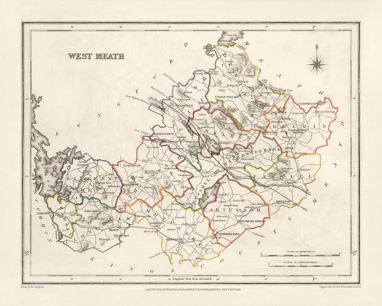
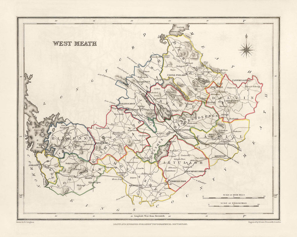


Mappa antica della Contea di Meath di Samuel Lewis, 1844: Navan, Trim, Kells, Athboy, Collina di Tara

- All taxes and duties included
- Handmade & dispatched in 1-2 days
-
90 day money back guarantee
ⓘ
90 giorni per restituire e ottenere un rimborso
I prodotti possono essere restituiti entro 90 giorni per un rimborso completo, o scambio con un altro prodotto.
Per articoli personalizzati o su misura, potremmo offrirti un credito in negozio o una carta regalo non scadente, poiché non possiamo rivendere ordini personalizzati.
Se hai domande, contattaci. Per ulteriori informazioni, consulta la nostra politica di restituzione e scambio.

My maps are rare, museum-grade, restored old maps sourced from libraries, auction houses and private collections across the globe.
Framing & free personalisation available
1. Select your size
2. Frame & personalise your map
Make your map unique with framing, hand-drawn customisation, vintage ageing, pop art text, unique 3D styling and moreGift message & custom finish

If you want to add a gift message, or a finish (jigsaw, aluminium board, etc.) that is not available here, please request it in the "order note" when you check out.
Every order is custom made, so if you need the size adjusted slightly, or printed on an unusual material, just let us know. We've done thousands of custom orders over the years, so there's (almost) nothing we can't manage.
You can also contact us before you order, if you prefer!

- Handmade locally. No import duty or tax
- FREE Delivery. Arrives in 2-3 days
- Love it or your money back
- Questions? WhatsApp me any time
Own a piece of history
5,000+ 5 star reviews


Questa mappa antica di Meath, realizzata con cura da Samuel Lewis nel 1844, è un pezzo affascinante di storia che offre uno sguardo nel passato. Con i suoi dettagli squisiti e la cartografia intricata, questa mappa è un must per qualsiasi appassionato di storia o collezionista.
Misurando [inserire dimensioni], questa mappa mostra i confini storici della contea di Meath, in Irlanda, così come erano nel 1844. Fornisce una prospettiva affascinante sul paesaggio, le città e i luoghi di riferimento della regione durante quell'epoca. Anche se alcune città moderne potrebbero non essere presenti su questa mappa, è un'opportunità emozionante per scoprire nomi precedenti di luoghi esistenti o esplorare insediamenti che si sono evoluti nel tempo.
La mappa antica di Meath di Samuel Lewis, 1844, presenta una ricchezza di informazioni e mette in evidenza l'importanza storica della regione. Offre una lente unica nel passato, permettendoti di seguire le orme di generazioni ormai scomparse. Che tu sia un appassionato di storia, un genealogista o semplicemente apprezzi la bellezza delle mappe antiche, questo pezzo è sicuro di affascinare e ispirare.
Insediamenti Notabili Fondati Prima del 1840:
-
Navan (c. 6° secolo): Navan, la città più grande della contea di Meath, ha una ricca storia che risale ai tempi antichi. È stata un importante centro durante il periodo medievale ed è conosciuta per i suoi siti storici, tra cui il Forte di Navan e le rovine del Castello di Navan.
-
Trim (c. 5° secolo): Trim è rinomata per le sue strutture medievali ben conservate, in particolare il Castello di Trim, il più grande castello anglo-normanno in Irlanda. Questa affascinante città vanta anche la Cattedrale di San Patrizio, che risale al 12° secolo.
-
Kells (c. 6° secolo): Kells è famosa per la sua associazione con il Libro di Kells, un manoscritto miniato dei quattro Vangeli creato intorno al 9° secolo. Il ricco patrimonio monastico della città è evidente nelle sue numerose antiche rovine e croci celtiche.
-
Athboy (c. 12° secolo): Athboy è intrisa di storia ed era una volta una significativa città di mercato. Presenta i resti del Convento Francescano di Athboy, un monastero medievale fondato nel 13° secolo.
-
Collina di Tara (Preistorico): La Collina di Tara ha un'enorme importanza archeologica e storica. Era il seggio antico dei Re Supremi d'Irlanda ed è punteggiata di antichi monumenti e tumuli funerari.
-
Duleek (c. 5° secolo): Duleek è una delle città più antiche d'Irlanda, con una storia che risale ai primi tempi cristiani. Vanta luoghi notevoli come l'Abbazia di Duleek, un sito monastico fondato nel 5° secolo.
-
Ratoath (c. 13° secolo): Ratoath ospita le rovine del Castello di Ratoath, una fortezza medievale costruita nel 13° secolo. La città presenta anche la storica Chiesa di Santa Maria, che risale al 12° secolo.
-
Dunshaughlin (c. 13° secolo): Dunshaughlin ha un ricco patrimonio medievale, con resti del suo passato visibili nelle rovine del Castello di Dunshaughlin. La storica Chiesa di San Seachnall della città risale al 10° secolo.
-
Oldcastle (c. 13° secolo): Oldcastle è conosciuta per il suo legame con la figura leggendaria di Sir Oliver Cromwell. La città presenta i notevoli resti di Oldcastle Motte e Bailey, una fortificazione medievale.
-
Enfield (c. 18° secolo): Enfield è una pittoresca città che è cresciuta attorno alla costruzione del Royal Canal alla fine del XVIII secolo. Offre un affascinante mix di storia e bellezze naturali.
-
Slane (c. VI secolo): Slane è famosa per il Castello di Slane, una villa del XVIII secolo immersa in un parco mozzafiato. La storia della città risale a tempi antichi ed è associata all'introduzione del cristianesimo in Irlanda.
-
Ashbourne (c. XVII secolo): Ashbourne è nota per il suo coinvolgimento nel Rising di Pasqua del 1916, un evento cruciale nella storia irlandese. L'importanza storica della città è commemorata attraverso vari monumenti e targhe.
-
Laytown (c. XVIII secolo): Laytown è una città costiera conosciuta per la sua bellissima spiaggia e il suo evento annuale di corse di cavalli, che si tiene dal XIX secolo. Offre una deliziosa fuga al mare.
-
Dunboyne (c. XVIII secolo): Dunboyne è una città vibrante con una ricca eredità equestre. Ospita il prestigioso Fairyhouse Racecourse, che è stato un importante luogo per le corse di cavalli sin dal XIX secolo.
-
Mornington (c. XVIII secolo): Mornington è un affascinante villaggio costiero noto per la sua costa panoramica e la storica torre Martello, costruita durante le guerre napoleoniche.
-
Clonee (c. XVII secolo): Clonee è una città in rapida crescita che ha assistito a uno sviluppo significativo negli ultimi anni. Offre un mix di comfort moderni e scorci del suo passato storico.
-
Johnstown (c. XVIII secolo): Johnstown è un pittoresco villaggio con un'atmosfera tranquilla. Presenta il Castello di Johnstown, una elegante villa del XIX secolo circondata da bellissimi giardini.
-
Dunshaughlin (c. XIII secolo): Dunshaughlin ha una ricca eredità medievale, con i resti del suo passato visibili nelle rovine del Castello di Dunshaughlin. La storica Chiesa di St. Seachnall risale al X secolo.
-
Oldcastle (c. XIII secolo): Oldcastle è nota per la sua connessione con la figura leggendaria di Sir Oliver Cromwell. La città presenta i notevoli resti di Oldcastle Motte e Bailey, una fortificazione medievale.
-
Enfield (c. XVIII secolo): Enfield è una pittoresca città che è cresciuta attorno alla costruzione del Royal Canal alla fine del XVIII secolo. Offre un affascinante mix di storia e bellezze naturali.
-
Slane (c. VI secolo): Slane è famosa per il Castello di Slane, una mansion del XVIII secolo situata in un parco mozzafiato. La storia della città risale ai tempi antichi ed è associata all'introduzione del cristianesimo in Irlanda.
-
Ashbourne (c. XVII secolo): Ashbourne è nota per il suo coinvolgimento nell'Easter Rising del 1916, un evento cruciale nella storia irlandese. L'importanza storica della città è commemorata attraverso vari monumenti e targhe.
-
Laytown (c. XVIII secolo): Laytown è una città costiera conosciuta per la sua bellissima spiaggia e il suo evento annuale di corse di cavalli, che si tiene dal XIX secolo. Offre una deliziosa fuga al mare.
-
Duleek (c. V secolo): Duleek è una delle città più antiche d'Irlanda, con una storia che risale ai primi tempi cristiani. Vanta luoghi notevoli come l'Abbazia di Duleek, un sito monastico fondato nel V secolo.
-
Ratoath (c. XIII secolo): Ratoath ospita le rovine del Castello di Ratoath, una fortezza medievale costruita nel XIII secolo. La città presenta anche la storica Chiesa di Santa Maria, che risale al XII secolo.
-
Kells (c. VI secolo): Kells è famosa per la sua associazione con il Libro di Kells, un manoscritto illuminato dei quattro Vangeli creato intorno al IX secolo. Il ricco patrimonio monastico della città è evidente nelle sue numerose rovine antiche e croci celtiche.
-
Athboy (c. XII secolo): Athboy è intrisa di storia ed era una volta una significativa città di mercato. Presenta i resti del Convento Francescano di Athboy, un monastero medievale fondato nel XIII secolo.
Confini, Fiumi e Fenomeni Naturali Notabili:
-
Fiume Boyne: Il Fiume Boyne scorre attraverso la Contea di Meath, intagliando una valle pittoresca e svolgendo un ruolo significativo nella storia della regione. È rinomato per la Battaglia di Boyne, un evento cruciale nella storia irlandese ed europea.
-
Collina di Tara: La Collina di Tara è un importante sito archeologico e complesso cerimoniale antico. Offre viste mozzafiato sulla campagna circostante ed è associata alla mitologia irlandese e ai Grandi Re d'Irlanda.
-
Cairns di Loughcrew: I Cairns di Loughcrew, noti anche come le Colline della Strega, sono una collezione di tombe a corridoio neolitiche risalenti a oltre 5.000 anni fa. Questi antichi siti funerari sono una testimonianza del patrimonio preistorico della regione.
-
Castello di Slane: Il Castello di Slane, situato sulle rive del Fiume Boyne, è una magnifica mansion del XVIII secolo circondata da un vasto parco. Ospita concerti ed eventi, aggiungendo al suo fascino.
-
Canale Reale: Il Canale Reale, che attraversa la Contea di Meath, è una storica via navigabile che ha svolto un ruolo vitale nei trasporti e nel commercio durante il XVIII e XIX secolo. Offre passeggiate panoramiche e opportunità di navigazione.
Eventi Storici nella Contea di Meath (1800-1850):
-
La Ribellione del 1798: La Contea di Meath ha visto un significativo coinvolgimento nella Ribellione del 1798, una ribellione contro il dominio britannico in Irlanda. La ribellione ha avuto un profondo impatto sulla regione, portando a tensioni crescenti e eventi successivi.
-
La Grande Carestia (1845-1852): La Contea di Meath, come il resto dell'Irlanda, ha subito gli effetti devastanti della Grande Carestia. Questo periodo di fame e difficoltà diffuse ha avuto un impatto duraturo sulla popolazione e sul tessuto sociale della regione.
-
Il Catholic Emancipation Act (1829): Il Catholic Emancipation Act, approvato nel 1829, ha concesso diritti politici ai cattolici in Irlanda. Questa legislazione ha avuto un impatto profondo sulla Contea di Meath, dove il cattolicesimo ha giocato un ruolo significativo nella comunità.
-
La Guerra dei Decimi (anni 1830): La Guerra dei Decimi, una serie di proteste contro il pagamento dei decimi alla Chiesa anglicana d'Irlanda, ha colpito anche la Contea di Meath. Questi conflitti riflettevano le tensioni tra le diverse comunità religiose nella regione.
-
La Crescita del Nazionalismo Irlandese: La prima metà del XIX secolo ha visto un aumento del nazionalismo irlandese, con la Contea di Meath che ha svolto un ruolo nel crescente movimento per l'indipendenza irlandese. Questo periodo ha visto l'emergere di figure e organizzazioni influenti che sostenevano l'autogoverno.
Nota: Questa mappa è una rappresentazione storica e non include città moderne né indica confini attuali.
Si prega di controllare le immagini per assicurarsi che una specifica città o luogo sia mostrato su questa mappa. Puoi anche contattarci e chiedere di controllare la mappa per te.
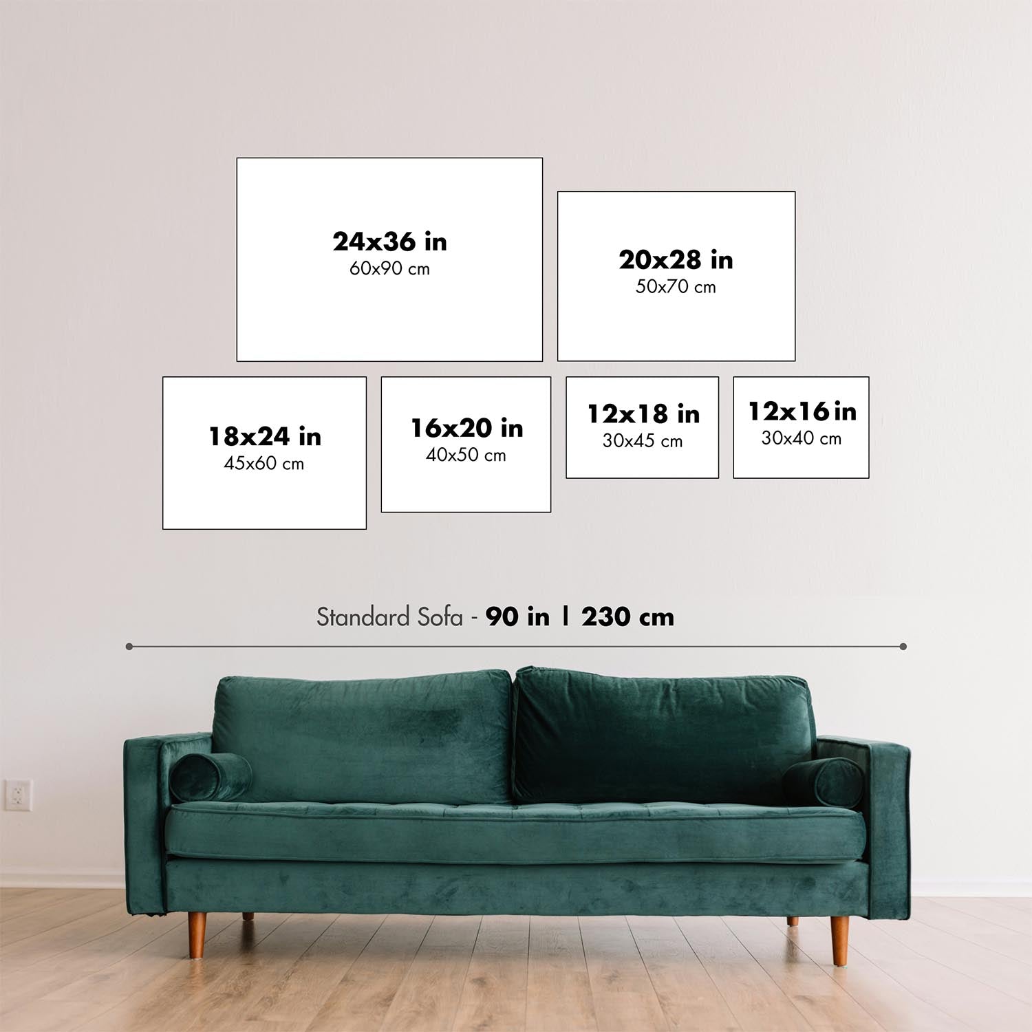
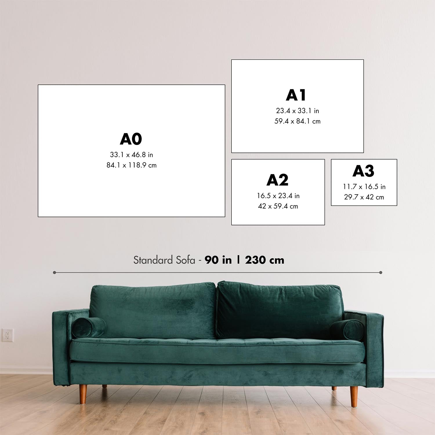
Questa mappa appare fantastica in tutte le dimensioni: 12x16in (30.5x41cm), 16x20in (40.5x51cm), 18x24in (45.5x61cm), 24x30in (61x76cm), 32x40in (81.5x102cm) e 40x50in (102x127cm), ma appare ancora meglio quando stampata in grande.
Posso creare stampe belle e grandi di questa mappa fino a 50in (127cm). Si prega di contattarmi se stai cercando opzioni di incorniciatura più grandi, personalizzate o diverse.
Il modello nelle immagini dell'annuncio tiene la versione 16x20in (40.5x51cm) di questa mappa.
La quinta immagine dell'annuncio mostra un esempio del mio servizio di personalizzazione della mappa.
Si prega di notare che la mappa non incorniciata 24x30in (61x76cm) ha bordi bianchi attorno alla mappa. Questi bordi possono aiutarti con l'incorniciatura, oppure se non ne hai bisogno, sono molto facili da tagliare con le forbici. Tutte le altre mappe, comprese le mappe incorniciate, sembrano esattamente come le immagini dell'annuncio.
Se stai cercando qualcosa di leggermente diverso, dai un'occhiata alla mia principale collezione di mappe del Regno Unito e dell'Irlanda.
Si prega di contattarmi per verificare se una certa posizione, punto di riferimento o caratteristica è mostrata su questa mappa.
Questo sarebbe un meraviglioso regalo di compleanno, Natale, Festa del Papà, partenza dal lavoro, anniversario o inaugurazione della casa per qualcuno delle aree coperte da questa mappa.
Questa mappa è disponibile come stampa giclée su carta opaca archiviata senza acidi, oppure puoi acquistarla incorniciata. La cornice è una bella e semplice cornice nera che si adatta alla maggior parte delle estetiche. Si prega di contattarmi se desideri un colore o un materiale di cornice diverso. Le mie cornici sono dotate di un acrilico (perspex/acrylite) di grado museale super chiaro, che è significativamente meno riflettente del vetro, più sicuro e arriverà sempre in perfette condizioni.
This map is also available as a float framed canvas, sometimes known as a shadow gap framed canvas or canvas floater. The map is printed on artist's cotton canvas and then stretched over a handmade box frame. We then "float" the canvas inside a wooden frame, which is available in a range of colours (black, dark brown, oak, antique gold and white). This is a wonderful way to present a map without glazing in front. See some examples of float framed canvas maps and explore the differences between my different finishes.
For something truly unique, this map is also available in "Unique 3D", our trademarked process that dramatically transforms the map so that it has a wonderful sense of depth. We combine the original map with detailed topography and elevation data, so that mountains and the terrain really "pop". For more info and examples of 3D maps, check my Unique 3D page.
For most orders, delivery time is about 3 working days. Personalised and customised products take longer, as I have to do the personalisation and send it to you for approval, which usually takes 1 or 2 days.
Please note that very large framed orders usually take longer to make and deliver.
If you need your order to arrive by a certain date, please contact me before you order so that we can find the best way of making sure you get your order in time.
I print and frame maps and artwork in 23 countries around the world. This means your order will be made locally, which cuts down on delivery time and ensures that it won't be damaged during delivery. You'll never pay customs or import duty, and we'll put less CO2 into the air.
All of my maps and art prints are well packaged and sent in a rugged tube if unframed, or surrounded by foam if framed.
I try to send out all orders within 1 or 2 days of receiving your order, though some products (like face masks, mugs and tote bags) can take longer to make.
If you select Express Delivery at checkout your order we will prioritise your order and send it out by 1-day courier (Fedex, DHL, UPS, Parcelforce).
Next Day delivery is also available in some countries (US, UK, Singapore, UAE) but please try to order early in the day so that we can get it sent out on time.
My standard frame is a gallery style black ash hardwood frame. It is simple and quite modern looking. My standard frame is around 20mm (0.8in) wide.
I use super-clear acrylic (perspex/acrylite) for the frame glass. It's lighter and safer than glass - and it looks better, as the reflectivity is lower.
Six standard frame colours are available for free (black, dark brown, dark grey, oak, white and antique gold). Custom framing and mounting/matting is available if you're looking for something else.
Most maps, art and illustrations are also available as a framed canvas. We use matte (not shiny) cotton canvas, stretch it over a sustainably sourced box wood frame, and then 'float' the piece within a wood frame. The end result is quite beautiful, and there's no glazing to get in the way.
All frames are provided "ready to hang", with either a string or brackets on the back. Very large frames will have heavy duty hanging plates and/or a mounting baton. If you have any questions, please get in touch.
See some examples of my framed maps and framed canvas maps.
Alternatively, I can also supply old maps and artwork on canvas, foam board, cotton rag and other materials.
If you want to frame your map or artwork yourself, please read my size guide first.
Alcune delle mie vecchie mappe sono ora disponibili come tele incorniciate. Per favore contattami se desideri ordinare una dimensione che non è disponibile nel mio negozio.
Le vecchie mappe su tela sono un'alternativa interessante alle mappe incorniciate in modo convenzionale. A seconda del tuo gusto personale e dell'arredamento della stanza, le mappe su tela possono "risaltare" un po' di più rispetto a una mappa incorniciata.
My maps are extremely high quality reproductions of original maps.
I source original, rare maps from libraries, auction houses and private collections around the world, restore them at my London workshop, and then use specialist giclée inks and printers to create beautiful maps that look even better than the original.
My maps are printed on acid-free archival matte (not glossy) paper that feels very high quality and almost like card. In technical terms the paper weight/thickness is 10mil/200gsm. It's perfect for framing.
I print with Epson ultrachrome giclée UV fade resistant pigment inks - some of the best inks you can find.
I can also make maps on canvas, cotton rag and other exotic materials.
Learn more about The Unique Maps Co.
Map personalisation
If you're looking for the perfect anniversary or housewarming gift, I can personalise your map to make it truly unique. For example, I can add a short message, or highlight an important location, or add your family's coat of arms.
The options are almost infinite. Please see my map personalisation page for some wonderful examples of what's possible.
To order a personalised map, select "personalise your map" before adding it to your basket.
Get in touch if you're looking for more complex customisations and personalisations.
Map ageing
I have been asked hundreds of times over the years by customers if they could buy a map that looks even older.
Well, now you can, by selecting Aged before you add a map to your basket.
All the product photos you see on this page show the map in its Original form. This is what the map looks like today.
If you select Aged, I will age your map by hand, using a special and unique process developed through years of studying old maps, talking to researchers to understand the chemistry of aging paper, and of course... lots of practice!
If you're unsure, stick to the Original colour of the map. If you want something a bit darker and older looking, go for Aged.
Se non sei soddisfatto del tuo ordine per qualsiasi motivo, contattami per un rimborso senza problemi. Si prega di consultare la nostra politica di reso e rimborso per ulteriori informazioni.
Sono molto sicuro che ti piacerà la tua mappa restaurata o la stampa d'arte. Lo faccio dal 1984. Sono un venditore Etsy a 5 stelle. Ho venduto decine di migliaia di mappe e stampe d'arte e ho oltre 5.000 recensioni reali a 5 stelle.
Utilizzo un processo unico per restaurare mappe e opere d'arte che richiede molto tempo e lavoro. Trovare le mappe e le illustrazioni originali può richiedere mesi. Utilizzo tecnologia all'avanguardia e incredibilmente costosa per scannerizzare e restaurarle. Di conseguenza, garantisco che le mie mappe e stampe d'arte siano superiori alle altre - ecco perché posso offrire un rimborso senza problemi.
Quasi tutte le mie mappe e stampe d'arte sembrano fantastiche a grandi dimensioni (200 cm, 6,5 piedi+) e posso anche incorniciarle e consegnarle a te, tramite un corriere speciale per oggetti di grandi dimensioni. Contattami per discutere delle tue esigenze specifiche.
Or try searching for something!


