

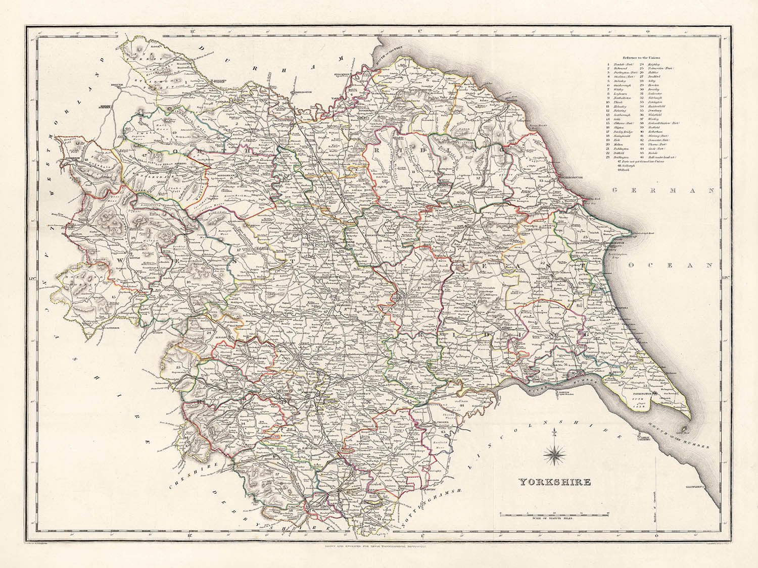
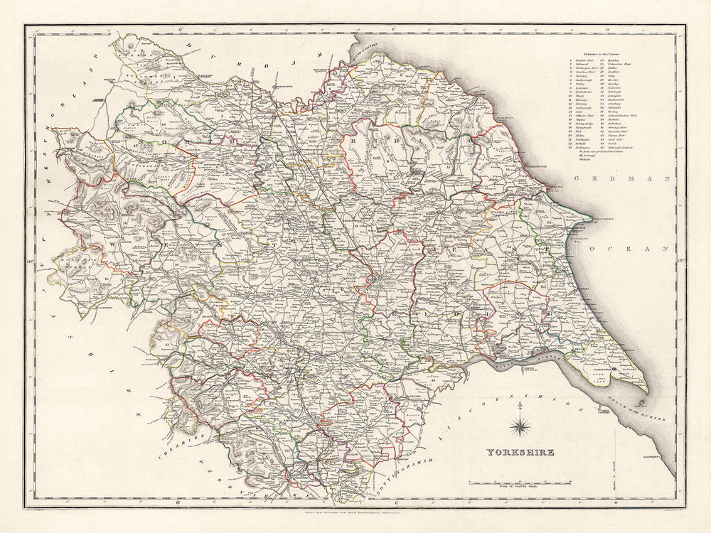


Vecchia mappa dello Yorkshire di Samuel Lewis, 1844: Leeds, Sheffield, Bradford, Kingston upon Hull e York

- All taxes and duties included
- Handmade & dispatched in 1-2 days
-
90 day money back guarantee
ⓘ
90 giorni per restituire e ottenere un rimborso
I prodotti possono essere restituiti entro 90 giorni per un rimborso completo, o scambio con un altro prodotto.
Per articoli personalizzati o su misura, potremmo offrirti un credito in negozio o una carta regalo non scadente, poiché non possiamo rivendere ordini personalizzati.
Se hai domande, contattaci. Per ulteriori informazioni, consulta la nostra politica di restituzione e scambio.

My maps are rare, museum-grade, restored old maps sourced from libraries, auction houses and private collections across the globe.
Framing & free personalisation available
1. Select your size
2. Frame & personalise your map
Make your map unique with framing, hand-drawn customisation, vintage ageing, pop art text, unique 3D styling and moreGift message & custom finish

If you want to add a gift message, or a finish (jigsaw, aluminium board, etc.) that is not available here, please request it in the "order note" when you check out.
Every order is custom made, so if you need the size adjusted slightly, or printed on an unusual material, just let us know. We've done thousands of custom orders over the years, so there's (almost) nothing we can't manage.
You can also contact us before you order, if you prefer!

- Handmade locally. No import duty or tax
- FREE Delivery. Arrives in 2-3 days
- Love it or your money back
- Questions? WhatsApp me any time
Own a piece of history
5,000+ 5 star reviews


Fai un passo indietro nel tempo con questa straordinaria mappa dettagliata dello Yorkshire del 1844, realizzata dal rinomato cartografo Samuel Lewis. Quest'opera d'arte rappresenta meticolosamente i confini storici della contea dello Yorkshire in un'epoca in cui molte delle sue città e paesi erano nelle prime fasi della loro ascesa industriale. È una finestra su un'epoca passata, in cui alcune città moderne potrebbero non essere ancora esistite, o esistere con un nome diverso, fornendo una narrazione intrigante sullo sviluppo di questa regione storicamente ricca.
Questo pezzo straordinario non solo ha un immenso valore storico, ma serve anche come un ottimo argomento di conversazione. Che si tratti della profonda trasformazione di Leeds da un modesto borgo di mercato a una vivace città industriale, o del fascino duraturo di York, questa mappa offre un'affascinante visione del passato dello Yorkshire. È un pezzo perfetto per storici, cartografi o chiunque abbia interesse per il ricco arazzo del passato dello Yorkshire. L'estetica senza tempo della mappa la rende un'ottima aggiunta a qualsiasi decorazione.
Città e paesi notevoli:- Leeds (5° secolo): Leeds era un piccolo borgo signorile nel XIII secolo e nei secoli successivi si espanse e sviluppò in un importante centro per la produzione e il commercio della lana.
- Sheffield (circa 8° secolo): Conosciuta per il suo ruolo significativo nella Rivoluzione Industriale, Sheffield iniziò come un piccolo villaggio centrato attorno al Castello di Sheffield.
- Bradford (Medioevo): Bradford crebbe rapidamente durante il XIX secolo come centro internazionale di produzione tessile, in particolare della lana.
- Kingston upon Hull (12° secolo): Fondata da Edoardo I, Hull è stata un mercato, un porto di rifornimento militare, un hub commerciale e una metropoli industriale.
- York (71 d.C.): Fondata dai Romani come Eboracum, York era la capitale della provincia romana della Britannia Inferior.
- Wakefield (Carta di Wakefield del 1203): Wakefield era soprannominata la "Merrie City" nel Medioevo ed era storicamente la capitale del West Riding dello Yorkshire.
- Doncaster (1° secolo d.C.): Originariamente un forte romano occupato chiamato Danum, Doncaster è da lungo tempo un'area ricca grazie alla sua importanza strategica sul fiume Don.
- Rotherham (9° secolo): Nel Medioevo, Rotherham era un centro chiave dell'industria del ferro e in seguito divenne un importante bacino carbonifero del sud dello Yorkshire.
- Halifax (12° secolo): Halifax è conosciuta per la sua ricca storia nella lana, la sua impressionante architettura vittoriana e il suo unico Piece Hall.
- Barnsley (Medioevo): Barnsley divenne un centro per la produzione di lino in Inghilterra, alimentato dal suo accesso a carbone e ferro.
- Huddersfield (1066): Huddersfield era un mercato noto per il suo ruolo nella Rivoluzione Industriale e per essere il luogo di nascita del rugby league.
- Harrogate (16° secolo): Una popolare meta turistica e città termale, le sue sorgenti furono scoperte nel XVI secolo.
- Scarborough (966 d.C.): Questa storica città balneare sulla costa del Mare del Nord è la prima località balneare della Gran Bretagna.
- Batley (Tardo Medioevo): Durante la Rivoluzione Industriale, Batley era uno dei principali centri per lo shoddy e il mungo, un tessuto economico realizzato con stracci di lana riciclati o triturati.
- Keighley (Medioevo): I mulini di Keighley producevano tessuti per equipaggiare i soldati, contribuendo notevolmente allo sforzo bellico durante le guerre napoleoniche.
- Castleford (Tempi Romani): La storia di Castleford risale ai tempi romani, quando era chiamata Lagentium.
- Parco Nazionale delle Yorkshire Dales: Fondato nel 1954, il parco è famoso per i suoi paesaggi mozzafiato, il ricco patrimonio culturale e la fauna selvatica diversificata.
- I North York Moors: Un parco nazionale con una delle più grandi distese di brughiera in Gran Bretagna.
- Fiume Ouse e Fiume Aire: Due fiumi principali che scorrono attraverso le Yorkshire, con sentieri pittoreschi e molta fauna selvatica.
- Ilkley Moor: Conosciuto per il suo habitat montano e i resti archeologici, è una meta popolare per passeggiate e arrampicate.
- Flamborough Head: Una delle aree più spettacolari di scogliere di gesso in Gran Bretagna, ospita uno dei più grandi siti di nidificazione di uccelli marini.
- La Guerra del 1812 (1812-1815): Questo conflitto ha coinvolto molti soldati delle Yorkshire, comprese le unità di Hull e Halifax.
- Rivolte Luddite (1811-1816): Scontri tra l'esercito britannico e i lavoratori che protestavano contro l'uso di macchinari nelle industrie della lana e del cotone.
- Apertura del Canale di Leeds e Liverpool (1816): Questa importante via di trasporto ha fornito un impulso economico alle città lungo il suo percorso.
- Formazione del Yorkshire County Cricket Club (1863): Fondato l'8 gennaio, è diventato uno dei club di cricket più di successo in Inghilterra.
- Il Great Reform Act (1832): Molte città delle Yorkshire, tra cui Leeds e Sheffield, hanno ottenuto rappresentanza in Parlamento grazie a questa legge.
- Fondazione di Middlesbrough (1830): Middlesbrough era un podere che si è trasformato in un gigante industriale grazie alle industrie del carbone e del ferro.
Si prega di controllare le immagini per assicurarsi che una specifica città o luogo sia mostrato su questa mappa. Puoi anche contattarci e chiedere di controllare la mappa per te.
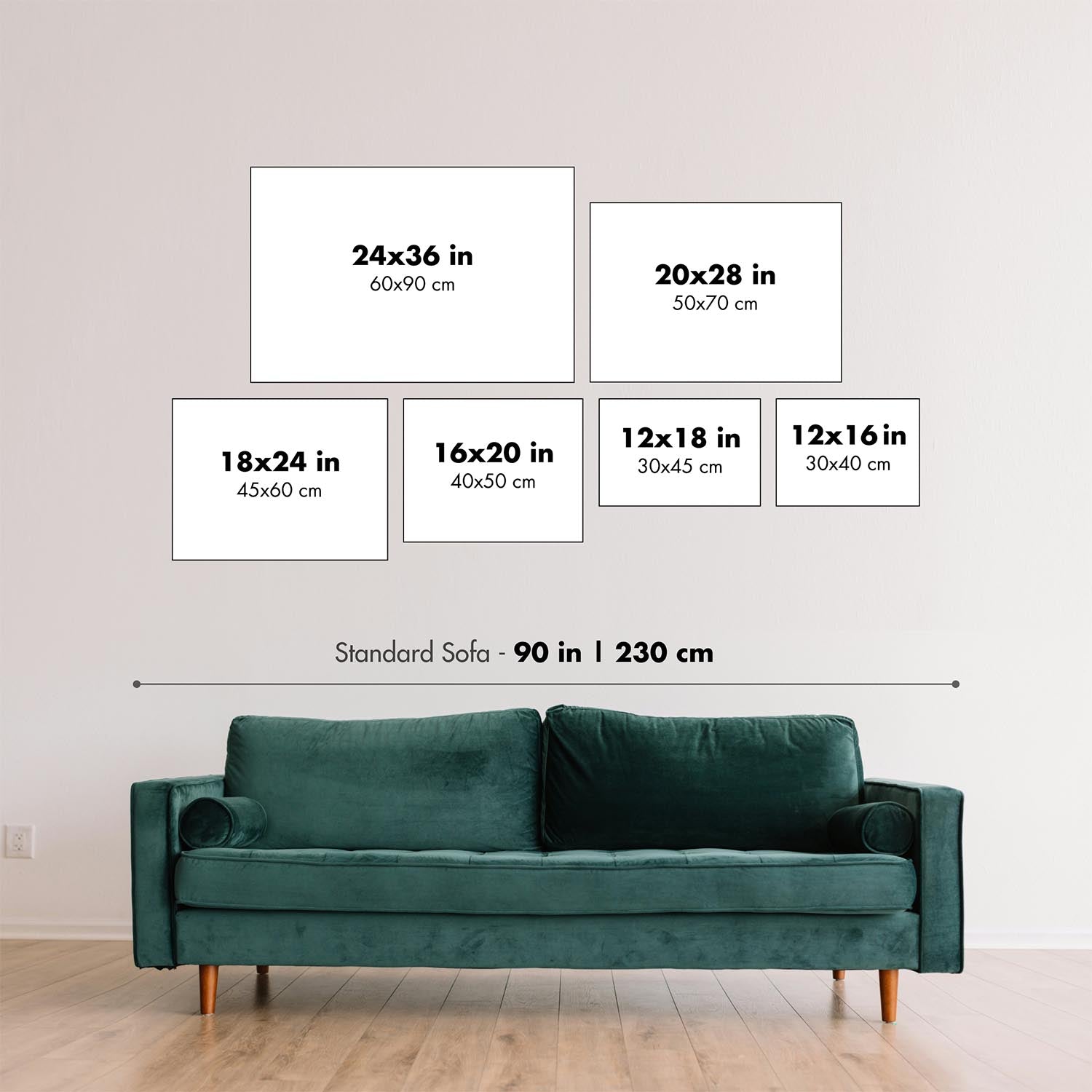
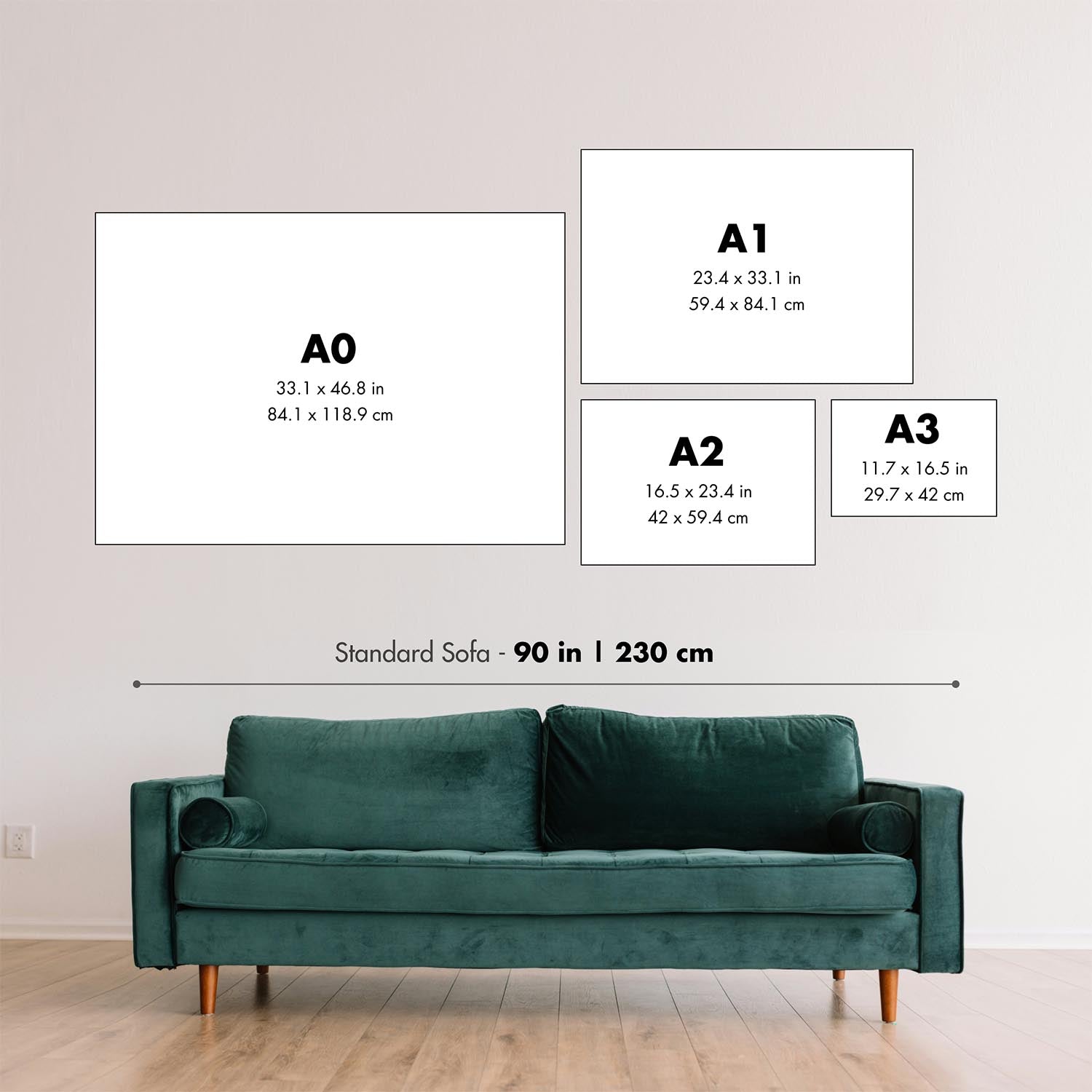
Questa mappa appare fantastica in tutte le dimensioni: 12x16in (30.5x41cm), 18x24in (45.5x61cm), 16x20in (40.5x51cm), 24x36in (61x91.5cm), 30x40in (76x101.5cm), 37x50in (94x127cm), 45x60in (114x152.5cm) e 52x70in (132x178cm), ma appare ancora meglio quando stampata in grande.
Posso creare bellissime stampe grandi di questa mappa fino a 50in (127cm). Ti prego di contattarmi se stai cercando opzioni di incorniciatura più grandi, personalizzate o diverse.
Il modello nelle immagini dell'annuncio tiene in mano la versione 18x24in (45.5x61cm) di questa mappa.
La quinta immagine dell'annuncio mostra un esempio del mio servizio di personalizzazione della mappa.
Le etichette su questa mappa sono molto piccole a 12x16in (30.5x41cm). La mappa è comunque molto attraente, ma potresti avere difficoltà a leggere le lettere più piccole. Ti prego di acquistare una mappa più grande se è importante poter leggere facilmente la mappa.
Se stai cercando qualcosa di leggermente diverso, dai un'occhiata alla mia principale collezione di mappe del Regno Unito e dell'Irlanda.
Per favore contattami per verificare se un certo luogo, punto di riferimento o caratteristica è mostrato su questa mappa.
Questo sarebbe un meraviglioso regalo per un compleanno, Natale, Festa del Papà, partenza dal lavoro, anniversario o inaugurazione di una casa per qualcuno delle aree coperte da questa mappa.
Questa mappa è disponibile come stampa giclée su carta opaca archiviata senza acidi, oppure puoi acquistarla incorniciata. La cornice è una semplice cornice nera che si adatta alla maggior parte degli stili. Ti prego di contattarmi se desideri un colore o materiale diverso per la cornice. Le mie cornici sono dotate di vetro acrilico super chiaro di grado museale (perspex/acrylite), che è significativamente meno riflettente del vetro, più sicuro e arriverà sempre in perfette condizioni.
This map is also available as a float framed canvas, sometimes known as a shadow gap framed canvas or canvas floater. The map is printed on artist's cotton canvas and then stretched over a handmade box frame. We then "float" the canvas inside a wooden frame, which is available in a range of colours (black, dark brown, oak, antique gold and white). This is a wonderful way to present a map without glazing in front. See some examples of float framed canvas maps and explore the differences between my different finishes.
For something truly unique, this map is also available in "Unique 3D", our trademarked process that dramatically transforms the map so that it has a wonderful sense of depth. We combine the original map with detailed topography and elevation data, so that mountains and the terrain really "pop". For more info and examples of 3D maps, check my Unique 3D page.
For most orders, delivery time is about 3 working days. Personalised and customised products take longer, as I have to do the personalisation and send it to you for approval, which usually takes 1 or 2 days.
Please note that very large framed orders usually take longer to make and deliver.
If you need your order to arrive by a certain date, please contact me before you order so that we can find the best way of making sure you get your order in time.
I print and frame maps and artwork in 23 countries around the world. This means your order will be made locally, which cuts down on delivery time and ensures that it won't be damaged during delivery. You'll never pay customs or import duty, and we'll put less CO2 into the air.
All of my maps and art prints are well packaged and sent in a rugged tube if unframed, or surrounded by foam if framed.
I try to send out all orders within 1 or 2 days of receiving your order, though some products (like face masks, mugs and tote bags) can take longer to make.
If you select Express Delivery at checkout your order we will prioritise your order and send it out by 1-day courier (Fedex, DHL, UPS, Parcelforce).
Next Day delivery is also available in some countries (US, UK, Singapore, UAE) but please try to order early in the day so that we can get it sent out on time.
My standard frame is a gallery style black ash hardwood frame. It is simple and quite modern looking. My standard frame is around 20mm (0.8in) wide.
I use super-clear acrylic (perspex/acrylite) for the frame glass. It's lighter and safer than glass - and it looks better, as the reflectivity is lower.
Six standard frame colours are available for free (black, dark brown, dark grey, oak, white and antique gold). Custom framing and mounting/matting is available if you're looking for something else.
Most maps, art and illustrations are also available as a framed canvas. We use matte (not shiny) cotton canvas, stretch it over a sustainably sourced box wood frame, and then 'float' the piece within a wood frame. The end result is quite beautiful, and there's no glazing to get in the way.
All frames are provided "ready to hang", with either a string or brackets on the back. Very large frames will have heavy duty hanging plates and/or a mounting baton. If you have any questions, please get in touch.
See some examples of my framed maps and framed canvas maps.
Alternatively, I can also supply old maps and artwork on canvas, foam board, cotton rag and other materials.
If you want to frame your map or artwork yourself, please read my size guide first.
Alcune delle mie vecchie mappe sono ora disponibili come tele incorniciate. Per favore contattami se desideri ordinare una dimensione che non è disponibile nel mio negozio.
Le vecchie mappe su tela sono un'alternativa interessante alle mappe incorniciate in modo convenzionale. A seconda del tuo gusto personale e dell'arredamento della stanza, le mappe su tela possono "risaltare" un po' di più rispetto a una mappa incorniciata.
My maps are extremely high quality reproductions of original maps.
I source original, rare maps from libraries, auction houses and private collections around the world, restore them at my London workshop, and then use specialist giclée inks and printers to create beautiful maps that look even better than the original.
My maps are printed on acid-free archival matte (not glossy) paper that feels very high quality and almost like card. In technical terms the paper weight/thickness is 10mil/200gsm. It's perfect for framing.
I print with Epson ultrachrome giclée UV fade resistant pigment inks - some of the best inks you can find.
I can also make maps on canvas, cotton rag and other exotic materials.
Learn more about The Unique Maps Co.
Map personalisation
If you're looking for the perfect anniversary or housewarming gift, I can personalise your map to make it truly unique. For example, I can add a short message, or highlight an important location, or add your family's coat of arms.
The options are almost infinite. Please see my map personalisation page for some wonderful examples of what's possible.
To order a personalised map, select "personalise your map" before adding it to your basket.
Get in touch if you're looking for more complex customisations and personalisations.
Map ageing
I have been asked hundreds of times over the years by customers if they could buy a map that looks even older.
Well, now you can, by selecting Aged before you add a map to your basket.
All the product photos you see on this page show the map in its Original form. This is what the map looks like today.
If you select Aged, I will age your map by hand, using a special and unique process developed through years of studying old maps, talking to researchers to understand the chemistry of aging paper, and of course... lots of practice!
If you're unsure, stick to the Original colour of the map. If you want something a bit darker and older looking, go for Aged.
Se non sei soddisfatto del tuo ordine per qualsiasi motivo, contattami per un rimborso senza problemi. Si prega di consultare la nostra politica di reso e rimborso per ulteriori informazioni.
Sono molto sicuro che ti piacerà la tua mappa restaurata o la stampa d'arte. Lo faccio dal 1984. Sono un venditore Etsy a 5 stelle. Ho venduto decine di migliaia di mappe e stampe d'arte e ho oltre 5.000 recensioni reali a 5 stelle.
Utilizzo un processo unico per restaurare mappe e opere d'arte che richiede molto tempo e lavoro. Trovare le mappe e le illustrazioni originali può richiedere mesi. Utilizzo tecnologia all'avanguardia e incredibilmente costosa per scannerizzare e restaurarle. Di conseguenza, garantisco che le mie mappe e stampe d'arte siano superiori alle altre - ecco perché posso offrire un rimborso senza problemi.
Quasi tutte le mie mappe e stampe d'arte sembrano fantastiche a grandi dimensioni (200 cm, 6,5 piedi+) e posso anche incorniciarle e consegnarle a te, tramite un corriere speciale per oggetti di grandi dimensioni. Contattami per discutere delle tue esigenze specifiche.
Or try searching for something!


