

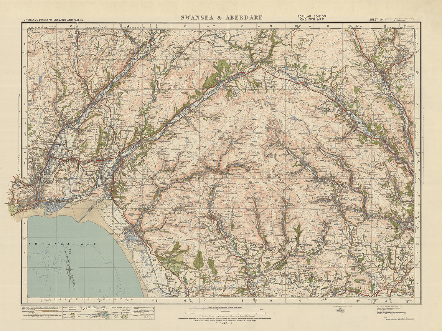


Mappa dell'Ordnance Survey Antica, Foglio 101: Swansea & Aberdare, 1925: Merthyr Tydfil, Neath, Port Talbot, Pontypridd
20% di sconto su 2 — 33% di sconto su 3
Aggiungi qualsiasi due articoli idonei al tuo carrello per ricevere 20% di sconto. Aggiungi un terzo e sarà gratuito (equivalente a 33% di sconto quando acquisti tre).
Nessun codice necessario — l'offerta si applica automaticamente al checkout.
Valido su tutte le mappe standard e le stampe d'arte fine. Puoi mescolare e abbinare qualsiasi design.
Se desideri spedire articoli a più indirizzi, ti preghiamo di contattarci prima di effettuare il tuo ordine.
Le commissioni personalizzate e su misura sono escluse.
Contattaci se hai domande

Choose your size
Choose your finish


(Maggiori informazioni)
Gift message & custom finish

If you want to add a gift message, or a finish (jigsaw, aluminium board, etc.) that is not available here, please request it in the "order note" when you check out.
Every order is custom made, so if you need the size adjusted slightly, or printed on an unusual material, just let us know. We've done thousands of custom orders over the years, so there's (almost) nothing we can't manage.
You can also contact us before you order, if you prefer!

- Made locally for fast, safe delivery
- No import duty or hidden fees
- Need advice? Message us on WhatsApp
Own a piece of history
7,000+ 5 star reviews


Questa vecchia mappa dell'Ordnance Survey, foglio 101 - Swansea & Aberdare, 1925, offre uno sguardo affascinante sul passato, mettendo in mostra le città e i paesaggi di Swansea, Aberdare e delle aree circostanti in Inghilterra e Galles. Questa mappa, parte dell'edizione One-inch "Popular" pubblicata da Ordnance Survey, offre una prospettiva storica unica, consentendovi di esplorare la regione così come appariva quasi un secolo fa.
Questa mappa è particolarmente intrigante per la sua rappresentazione di insediamenti e caratteristiche di rilievo che si sono evoluti nel tempo. Sebbene Swansea e Aberdare siano al centro della scena, è importante notare che alcune città moderne potrebbero non essere presenti su questa mappa. Tuttavia, l'inclusione di denominazioni precedenti per alcune località aggiunge un entusiasmante elemento di scoperta. La storica contea di Glamorgan, che comprende Swansea e Aberdare, accresce ulteriormente il significato della mappa, offrendo preziose informazioni sul passato della regione.
Principali insediamenti e caratteristiche:
- Swansea: una vivace città costiera nota per il suo patrimonio industriale, le splendide spiagge e il dinamico panorama culturale.
- Aberdare: una storica città mineraria incastonata nella Cynon Valley, che offre uno sguardo sul passato carbonifero della regione.
- Merthyr Tydfil: un tempo fiorente città produttrice di ferro, Merthyr Tydfil ebbe un ruolo cruciale nella Rivoluzione industriale.
- Neath: una città mercato dalla ricca storia che risale all'epoca romana, nota per i suoi dintorni pittoreschi e i suoi monumenti storici.
- Port Talbot: una città costiera rinomata per la sua industria siderurgica e le sue splendide spiagge.
- Pontypridd: situata sulle rive del fiume Taff, Pontypridd è famosa per il suo iconico Old Bridge e per il suo legame con il poeta gallese R.S. Thomas.
Confini, fiumi e fenomeni naturali di rilievo:
- River Tawe: attraversando Swansea, questo fiume è un elemento significativo del paesaggio della regione.
- Afan Forest Park: situato vicino a Port Talbot, questo vasto bosco offre una bellezza naturale mozzafiato e opportunità ricreative.
- Brecon Beacons National Park: subito a nord di Merthyr Tydfil, questo parco nazionale comprende spettacolari catene montuose, tra cui Pen y Fan, la vetta più alta del Galles meridionale.
Eventi storici (entro 20 anni precedenti il 1925):
- 1904: Tonypandy Riots: una serie di violenti scontri tra i minatori di carbone in sciopero e la polizia nella Rhondda Valley, che evidenziarono le lotte della classe lavoratrice durante i primi anni del XX secolo.
- 1913-1914: Cambrian Colliery Disaster: un incidente minerario a Clydach Vale, Rhondda, che causò la perdita di 290 vite, rendendolo uno dei peggiori disastri minerari della storia gallese.
Immergetevi nel passato con questa mappa meticolosamente dettagliata, che cattura l'essenza di Swansea, Aberdare e delle città vicine nel 1925. Che siate appassionati di storia, amanti della cartografia o semplicemente alla ricerca di un pezzo unico ed educativo da esporre alla parete, questa vecchia mappa dell'Ordnance Survey saprà sicuramente suscitare curiosità e conversazione.
Verificate attentamente le immagini per assicurarvi che una specifica città o località sia presente su questa mappa. Potete anche contattarci e chiedere di verificare la mappa per voi.
Questa mappa ha un aspetto straordinario in tutte le dimensioni: 12x16in (30.5x41cm), 18x24in (45.5x61cm), 16x20in (40.5x51cm), 24x36in (61x91.5cm), 30x40in (76x101.5cm), 37x50in (94x127cm), 45x60in (114x152.5cm) e 52x70in (132x178cm), ma risulta ancora più bella se stampata in grande formato.
Posso realizzare splendide stampe di grandi dimensioni di questa mappa fino a 90 pollici (229 cm). Contattatemi se cercate formati più grandi, personalizzati o opzioni di cornice diverse.
Il modello nelle immagini dell'inserzione tiene in mano la versione 18x24 pollici (45,5x61 cm) di questa mappa.
La quinta immagine dell'inserzione mostra un esempio del mio servizio di personalizzazione delle mappe.
Le etichette su questa mappa sono molto piccole nel formato 12x16 pollici (30,5x41 cm). La mappa resta comunque molto attraente, ma potreste avere difficoltà a leggere le lettere più piccole. Acquistate una mappa più grande se per voi è importante riuscire a leggere la mappa con facilità.
Se cercate qualcosa di leggermente diverso, date un'occhiata alla mia principale collezione di mappe di Regno Unito e Irlanda.
Vi prego di contattarmi per verificare se una certa località, monumento o elemento è presente su questa mappa.
Sarebbe un meraviglioso regalo di compleanno, Natale, Festa del Papà, addio al lavoro, anniversario o per inaugurare una nuova casa per qualcuno proveniente dalle zone rappresentate in questa mappa.
Questa mappa è disponibile come stampa giclée su carta opaca archivistica senza acidi, oppure potete acquistarla incorniciata. La cornice è una bella e semplice cornice nera, adatta alla maggior parte degli stili. Contattatemi se desiderate un colore o un materiale della cornice diverso. Le mie cornici sono montate con acrilico di qualità museale super trasparente (perspex/acrylite), molto meno riflettente del vetro, più sicuro e che arriverà sempre in perfette condizioni.
This map is also available as a float framed canvas, sometimes known as a shadow gap framed canvas or canvas floater. The map is printed on artist's cotton canvas and then stretched over a handmade box frame. We then "float" the canvas inside a wooden frame, which is available in a range of colours (black, dark brown, oak, antique gold and white). This is a wonderful way to present a map without glazing in front. See some examples of float framed canvas maps and explore the differences between my different finishes.
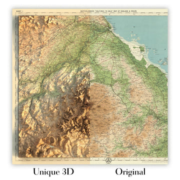
For something truly unique, this map is also available in "Unique 3D", our trademarked process that dramatically transforms the map so that it has a wonderful sense of depth. We combine the original map with detailed topography and elevation data, so that mountains and the terrain really "pop". For more info and examples of 3D maps, check my Unique 3D page.
Many of our maps and art prints are chosen as thoughtful gifts for homes, offices, studies and meaningful places.
Choose a framed option for the easiest ready-to-hang gift, or choose an unframed print if the recipient may prefer to select their own frame.
We make orders locally in 23 countries around the world, so gifts can often be produced close to the recipient. This helps them arrive faster, travel more safely, and avoid customs or import duty surprises.
- We can deliver directly to the recipient
- Framed pieces arrive ready to hang
- Unframed prints are carefully packed in a strong protective tube
- Almost every order is made locally, for faster, safer gifting
- 90-day returns give the recipient time to decide
If you are not sure what to choose, please contact us. We can help you pick the right map, size, finish or delivery option.
Most orders are made locally and delivered in around 2–3 working days, depending on the product, size and destination.
We print and frame maps and artwork in 23 countries around the world, so your order is usually made close to you or your recipient. That means faster delivery, less time in transit, and no customs or import duty surprises.
Personalised and customised pieces usually take an extra 1–2 working days, because we prepare your design and send it to you for approval before printing.
Very large framed orders can take a little longer, as they need extra care in production and delivery.
Every order is carefully packaged: unframed prints are sent in a strong protective tube, while framed pieces are securely packed with protective materials around the frame.
If you need your order by a particular date, please contact us before ordering. We’ll check the best production route and delivery option for your location.
Express delivery is available at checkout for most countries. Next-day delivery is available in the UK, US, Singapore and the UAE.
Your order is covered by our 90-day returns policy and 10-year guarantee.
Our standard frame is a gallery-style black ash hardwood frame, with a simple, modern look. It is approximately 20mm (0.8in) wide. You can also view some lovely customer photos of framed maps and art.
We use super-clear acrylic glazing, also known as Perspex or Acrylite, instead of traditional glass. It is lighter, safer, and has lower reflectivity, giving the artwork a clearer, cleaner appearance.
Six standard frame colours are available at no extra cost: black, dark brown, dark grey, oak, white, and antique gold. Custom framing and mounting/matting is also available for customers looking for something more specific.
Most maps, art prints, and illustrations are also available as a framed canvas. We use matte cotton canvas, stretch it over a sustainably sourced wooden box frame, and then float the piece within a wooden outer frame. The finished result is beautifully presented, with no glazing between you and the artwork.
All frames are supplied ready to hang, with either string or brackets fitted to the back. Very large frames will include heavy-duty hanging plates and/or a mounting baton. If you have any questions, please get in touch.
We can also supply old maps and artwork on canvas, foam board, cotton rag, and other materials.
If you would prefer to frame your map or artwork yourself, please read our size guide before ordering.
My maps are extremely high quality reproductions of original maps.
I source original, rare maps from libraries, auction houses and private collections around the world, restore them at my London workshop, and then use specialist giclée inks and printers to create beautiful maps that look even better than the original.
My maps are printed on acid-free archival matte (not glossy) paper that feels very high quality and almost like card. In technical terms the paper weight/thickness is 10mil/200gsm. It's perfect for framing.
I print with Epson ultrachrome giclée UV fade resistant pigment inks - some of the best inks you can find.
I can also make maps on canvas, cotton rag and other exotic materials.
Learn more about The Unique Maps Co.
Map personalisation
If you're looking for the perfect anniversary or housewarming gift, I can personalise your map to make it truly unique. For example, I can add a short message, or highlight an important location, or add your family's coat of arms.
The options are almost infinite. Please see my map personalisation page for some wonderful examples of what's possible.
To order a personalised map, select "personalise your map" before adding it to your basket.
Get in touch if you're looking for more complex customisations and personalisations.
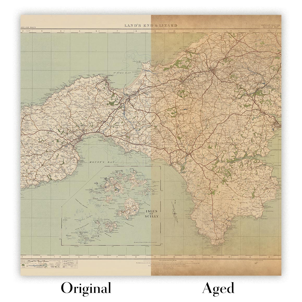
Map ageing
I have been asked hundreds of times over the years by customers if they could buy a map that looks even older.
Well, now you can, by selecting Aged before you add a map to your basket.
All the product photos you see on this page show the map in its Original form. This is what the map looks like today.
If you select Aged, I will age your map by hand, using a special and unique process developed through years of studying old maps, talking to researchers to understand the chemistry of aging paper, and of course... lots of practice!
If you're unsure, stick to the Original colour of the map. If you want something a bit darker and older looking, go for Aged.
Se non sei soddisfatto del tuo ordine per qualsiasi motivo, contattami per un rimborso senza problemi. Si prega di consultare la nostra politica di reso e rimborso per ulteriori informazioni.
Sono molto sicuro che ti piacerà la tua mappa restaurata o la stampa d'arte. Lo faccio dal 1984. Sono un venditore Etsy a 5 stelle. Ho venduto decine di migliaia di mappe e stampe d'arte e ho oltre 5.000 recensioni reali a 5 stelle.
Utilizzo un processo unico per restaurare mappe e opere d'arte che richiede molto tempo e lavoro. Trovare le mappe e le illustrazioni originali può richiedere mesi. Utilizzo tecnologia all'avanguardia e incredibilmente costosa per scannerizzare e restaurarle. Di conseguenza, garantisco che le mie mappe e stampe d'arte siano superiori alle altre - ecco perché posso offrire un rimborso senza problemi.
Quasi tutte le mie mappe e stampe d'arte sembrano fantastiche a grandi dimensioni (200 cm, 6,5 piedi+) e posso anche incorniciarle e consegnarle a te, tramite un corriere speciale per oggetti di grandi dimensioni. Contattami per discutere delle tue esigenze specifiche.
Or try searching for something!


