


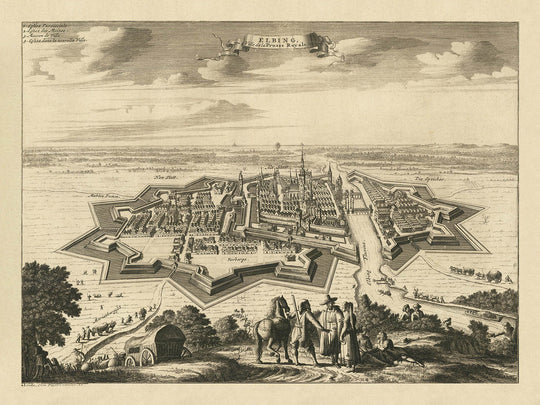


Old Bird's Eye Map of Elbląg, Poland, 1725: Fortified Walls, Maritime Routes, Churches, Rural Landscape
- All taxes and duties included
- Handmade & dispatched in 1-2 days
-
90 day money back guarantee
ⓘ
90 days to return and refund
Products can be returned within 90 days for a full refund, or exchange for another product.
For personalised and custom made items, we may offer you store credit or a non-expiring gift card, as we cannot resell personalised orders.
If you have any questions, get in touch. For more information, see our full returns & exchanges policy.

My maps are rare, museum-grade, restored old maps sourced from libraries, auction houses and private collections across the globe.
Framing & free personalisation available
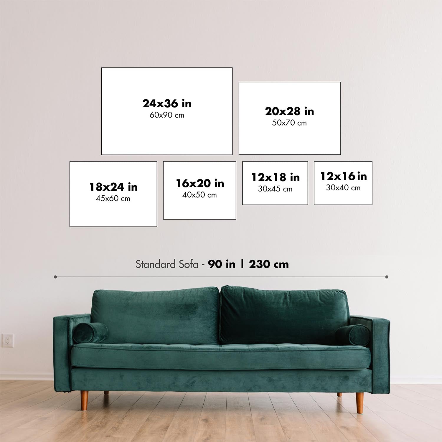
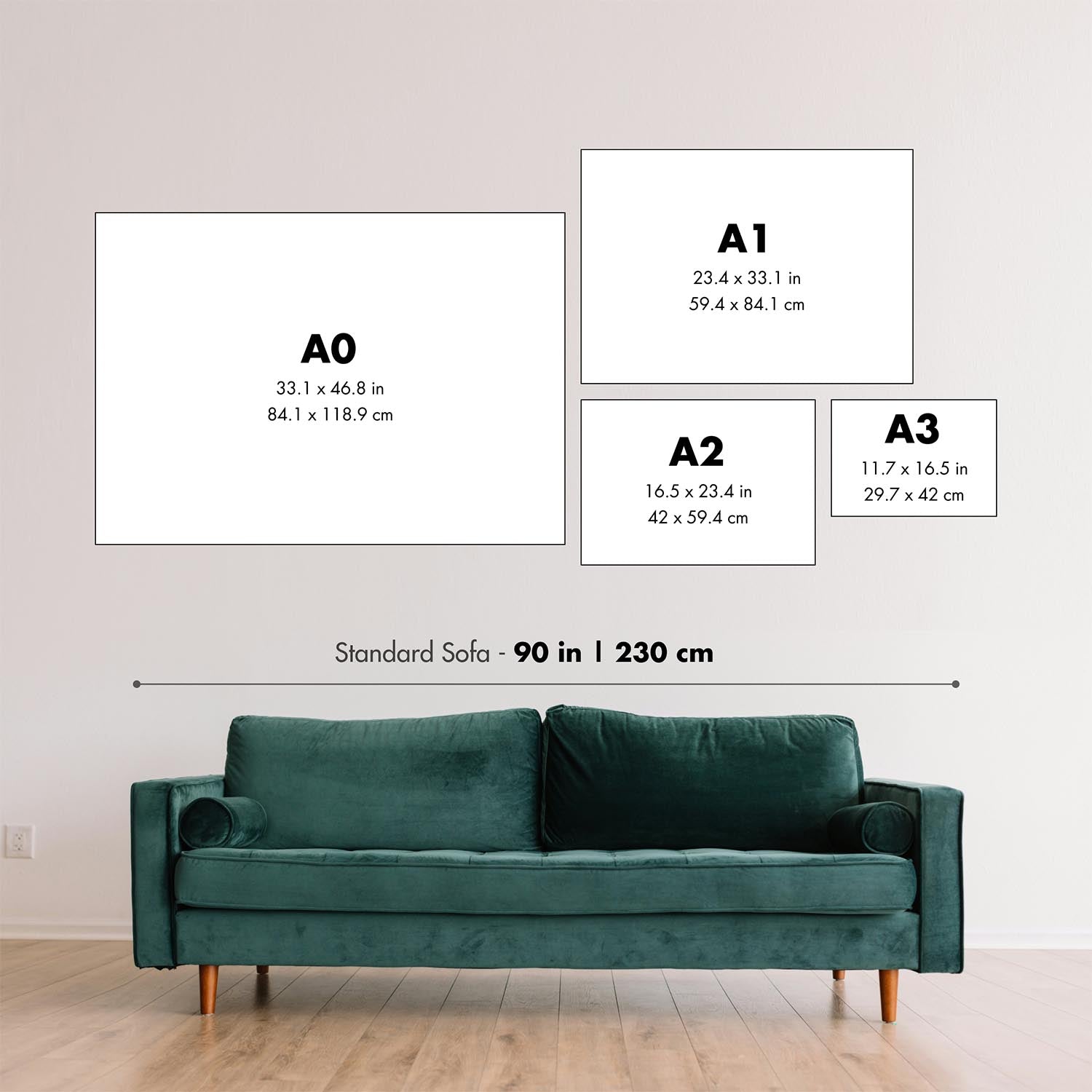
1. Select your size
2. Frame & personalise your map
Make your map unique with framing, hand-drawn customisation, vintage ageing, pop art text, unique 3D styling and moreGift message & custom finish

If you want to add a gift message, or a finish (jigsaw, aluminium board, etc.) that is not available here, please request it in the "order note" when you check out.
Every order is custom made, so if you need the size adjusted slightly, or printed on an unusual material, just let us know. We've done thousands of custom orders over the years, so there's (almost) nothing we can't manage.
You can also contact us before you order, if you prefer!

- Handmade locally. No import duty or tax
- FREE Delivery. Arrives in 2-3 days
- Love it or your money back
- Questions? WhatsApp me any time
Own a piece of history
5,000+ 5 star reviews


Step into the storied past of Northern Europe with "Elbing, Ville de la Prusse Royale," an exquisite 1725 bird’s-eye view of Elbląg—historically known as Elbing—crafted by the renowned Dutch cartographer Pieter van der Aa. This remarkable map captures the fortified city in stunning detail, offering a rare glimpse into the urban and architectural landscape of Royal Prussia during the early 18th century. The original French title, elegantly displayed within a decorative ribbon cartouche, immediately sets the tone for a piece that is as much a work of art as it is a historical document.
Elbląg’s strategic importance as a trade hub and fortified stronghold is vividly illustrated in this map. The meticulously rendered city walls and bastions speak to its role as a defensive bulwark, while the bustling waterways and ships depicted on the river highlight its maritime connections. The city’s layout is brought to life through the careful depiction of churches, towers, and densely clustered buildings, all nestled within the embrace of robust fortifications. The surrounding rural landscape, complete with fields and verdant vegetation, frames the city and hints at the agricultural richness that supported its prosperity.
One of the most captivating aspects of this map is its ability to transport the viewer into the daily rhythms of 18th-century Elbląg. The presence of costumed figures in the foreground adds a lively, human dimension, offering a window into the fashions and social life of the era. The waterways—arteries of commerce and communication—are populated with boats and ships, underscoring the city’s vibrant trade and its pivotal role in the Baltic region. The detailed rendering of architectural landmarks invites closer inspection, rewarding the viewer with a sense of discovery and connection to the city’s historical fabric.
Pieter van der Aa, the master behind this map, was celebrated for his precision, artistry, and ability to capture the essence of European cities at the height of their historical significance. His works are prized by collectors and historians alike for their blend of accuracy and decorative flourish. In this map, van der Aa’s skill is evident not only in the technical rendering of Elbląg’s fortifications and urban core but also in the imaginative embellishments that make the scene come alive. His unique perspective offers both a practical record and a romanticized vision of a city at the crossroads of commerce, culture, and conflict.
For connoisseurs of cartographic history, "Elbing, Ville de la Prusse Royale" stands as a testament to the enduring allure of city maps. It encapsulates the grandeur and complexity of a major urban center in Royal Prussia, capturing both its physical form and its historical spirit. Whether admired for its artistic beauty, its documentary value, or its evocation of a bygone era, this map is a centerpiece for any collection—an invitation to explore the intricate interplay of geography, history, and human endeavor that shaped the cities of early modern Europe.
Streets and roads on this map
- No streets or roads are clearly labelled or legible on this map image. Therefore, this section cannot be completed.
Notable Features & Landmarks
- Clearly depicted fortified city walls and bastions
- Detailed representation of city buildings, churches, and towers
- Prominent waterways and canals running through and around the city
- Decorative ribbon cartouche with the title "Elbing, Ville de la Prusse Royale"
- Costumed figures depicted in the foreground, adding decorative and cultural context
- Surrounding rural landscape, fields, and vegetation clearly illustrated
- Ships and boats depicted on waterways, indicating the city's maritime and trade importance
Historical and design context
- Created in 1725 by Pieter van der Aa, a notable Dutch publisher and cartographer known for detailed city views and maps in the early 18th century
- Depicts the city of Elbląg (Elbing), located in northern Poland, within the historical region of Royal Prussia
- The map is a pictorial bird's-eye view, offering a detailed and artistic representation of the city layout, fortifications, and surrounding landscape
- Emphasizes the fortified nature of the city, highlighting its strategic and defensive significance
- Elbląg was historically important as a trading city within Royal Prussia, part of the Polish-Lithuanian Commonwealth at the time
- Includes decorative elements such as a ribbon cartouche and costumed figures in the foreground, typical of Pieter van der Aa's detailed and ornamental style
Please double check the images to make sure that a specific town or place is shown on this map. You can also get in touch and ask us to check the map for you.
This map looks great at every size, but I always recommend going for a larger size if you have space. That way you can easily make out all of the details.
This map looks amazing at sizes all the way up to 50in (125cm). If you are looking for a larger map, please get in touch.
The model in the listing images is holding the 18x24in (45x60cm) version of this map.
The fifth listing image shows an example of my map personalisation service.
If you’re looking for something slightly different, check out my collection of the best old maps to see if something else catches your eye.
Please contact me to check if a certain location, landmark or feature is shown on this map.
This would make a wonderful birthday, Christmas, Father's Day, work leaving, anniversary or housewarming gift for someone from the areas covered by this map.
This map is available as a giclée print on acid free archival matte paper, or you can buy it framed. The frame is a nice, simple black frame that suits most aesthetics. Please get in touch if you'd like a different frame colour or material. My frames are glazed with super-clear museum-grade acrylic (perspex/acrylite), which is significantly less reflective than glass, safer, and will always arrive in perfect condition.
This map is also available as a float framed canvas, sometimes known as a shadow gap framed canvas or canvas floater. The map is printed on artist's cotton canvas and then stretched over a handmade box frame. We then "float" the canvas inside a wooden frame, which is available in a range of colours (black, dark brown, oak, antique gold and white). This is a wonderful way to present a map without glazing in front. See some examples of float framed canvas maps and explore the differences between my different finishes.
For something truly unique, this map is also available in "Unique 3D", our trademarked process that dramatically transforms the map so that it has a wonderful sense of depth. We combine the original map with detailed topography and elevation data, so that mountains and the terrain really "pop". For more info and examples of 3D maps, check my Unique 3D page.
For most orders, delivery time is about 3 working days. Personalised and customised products take longer, as I have to do the personalisation and send it to you for approval, which usually takes 1 or 2 days.
Please note that very large framed orders usually take longer to make and deliver.
If you need your order to arrive by a certain date, please contact me before you order so that we can find the best way of making sure you get your order in time.
I print and frame maps and artwork in 23 countries around the world. This means your order will be made locally, which cuts down on delivery time and ensures that it won't be damaged during delivery. You'll never pay customs or import duty, and we'll put less CO2 into the air.
All of my maps and art prints are well packaged and sent in a rugged tube if unframed, or surrounded by foam if framed.
I try to send out all orders within 1 or 2 days of receiving your order, though some products (like face masks, mugs and tote bags) can take longer to make.
If you select Express Delivery at checkout your order we will prioritise your order and send it out by 1-day courier (Fedex, DHL, UPS, Parcelforce).
Next Day delivery is also available in some countries (US, UK, Singapore, UAE) but please try to order early in the day so that we can get it sent out on time.
My standard frame is a gallery style black ash hardwood frame. It is simple and quite modern looking. My standard frame is around 20mm (0.8in) wide.
I use super-clear acrylic (perspex/acrylite) for the frame glass. It's lighter and safer than glass - and it looks better, as the reflectivity is lower.
Six standard frame colours are available for free (black, dark brown, dark grey, oak, white and antique gold). Custom framing and mounting/matting is available if you're looking for something else.
Most maps, art and illustrations are also available as a framed canvas. We use matte (not shiny) cotton canvas, stretch it over a sustainably sourced box wood frame, and then 'float' the piece within a wood frame. The end result is quite beautiful, and there's no glazing to get in the way.
All frames are provided "ready to hang", with either a string or brackets on the back. Very large frames will have heavy duty hanging plates and/or a mounting baton. If you have any questions, please get in touch.
See some examples of my framed maps and framed canvas maps.
Alternatively, I can also supply old maps and artwork on canvas, foam board, cotton rag and other materials.
If you want to frame your map or artwork yourself, please read my size guide first.
My maps are extremely high quality reproductions of original maps.
I source original, rare maps from libraries, auction houses and private collections around the world, restore them at my London workshop, and then use specialist giclée inks and printers to create beautiful maps that look even better than the original.
My maps are printed on acid-free archival matte (not glossy) paper that feels very high quality and almost like card. In technical terms the paper weight/thickness is 10mil/200gsm. It's perfect for framing.
I print with Epson ultrachrome giclée UV fade resistant pigment inks - some of the best inks you can find.
I can also make maps on canvas, cotton rag and other exotic materials.
Learn more about The Unique Maps Co.
Map personalisation
If you're looking for the perfect anniversary or housewarming gift, I can personalise your map to make it truly unique. For example, I can add a short message, or highlight an important location, or add your family's coat of arms.
The options are almost infinite. Please see my map personalisation page for some wonderful examples of what's possible.
To order a personalised map, select "personalise your map" before adding it to your basket.
Get in touch if you're looking for more complex customisations and personalisations.
Map ageing
I have been asked hundreds of times over the years by customers if they could buy a map that looks even older.
Well, now you can, by selecting Aged before you add a map to your basket.
All the product photos you see on this page show the map in its Original form. This is what the map looks like today.
If you select Aged, I will age your map by hand, using a special and unique process developed through years of studying old maps, talking to researchers to understand the chemistry of aging paper, and of course... lots of practice!
If you're unsure, stick to the Original colour of the map. If you want something a bit darker and older looking, go for Aged.
If you are not happy with your order for any reason, contact me and I'll get it fixed ASAP, free of charge. Please see my returns and refund policy for more information.
I am very confident you will like your restored map or art print. I have been doing this since 1984. I'm a 5-star Etsy seller. I have sold tens of thousands of maps and art prints and have over 5,000 real 5-star reviews. My work has been featured in interior design magazines, on the BBC, and on the walls of dozens of 5-star hotels.
I use a unique process to restore maps and artwork that is massively time consuming and labour intensive. Hunting down the original maps and illustrations can take months. I use state of the art and eye-wateringly expensive technology to scan and restore them. As a result, I guarantee my maps and art prints are a cut above the rest. I stand by my products and will always make sure you're 100% happy with what you receive.
Almost all of my maps and art prints look amazing at large sizes (200cm, 6.5ft+) and I can frame and deliver them to you as well, via special oversized courier. Contact me to discuss your specific needs.
Or try searching for something!


