


Old map of Indiana by J.H. Colton, 1855: Indianapolis, Fort Wayne, New Albany, Terre Haute, Lafayette
- All taxes and duties included
- Handmade & dispatched in 1-2 days
-
FREE gift preview
ⓘ
Digital gift preview
New for 2025: After you complete your order, you can send a beautiful digital preview to the gift recipient. Just provide their email address and we'll do the rest. (Their email address will not be stored or used for any other purpose.)
This is perfect for Christmas gifting, particularly if you're concerned that your order might not arrive in time for Christmas.
-
90 day money back guarantee
ⓘ
90 days to return and refund
Products can be returned within 90 days for a full refund, or exchange for another product.
For personalised and custom made items, we may offer you store credit or a non-expiring gift card, as we cannot resell personalised orders.
If you have any questions, get in touch. For more information, see our full returns & exchanges policy.

My maps are rare, museum-grade, restored old maps sourced from libraries, auction houses and private collections across the globe.
Framing & free personalisation available
1. Select your size
2. Frame & personalise your map
There is limited framing & personalisation capacity available. Order by 10am tomorrow for Christmas delivery.


Gift message & custom finish

If you want to add a gift message, or a finish (jigsaw, aluminium board, etc.) that is not available here, please request it in the "order note" when you check out.
Every order is custom made, so if you need the size adjusted slightly, or printed on an unusual material, just let us know. We've done thousands of custom orders over the years, so there's (almost) nothing we can't manage.
You can also contact us before you order, if you prefer!

- Handmade locally. No import duty or tax
- FREE Delivery by Christmas
- Love it or your money back (90 days)
- Questions? WhatsApp me any time
Own a piece of history
5,000+ 5 star reviews


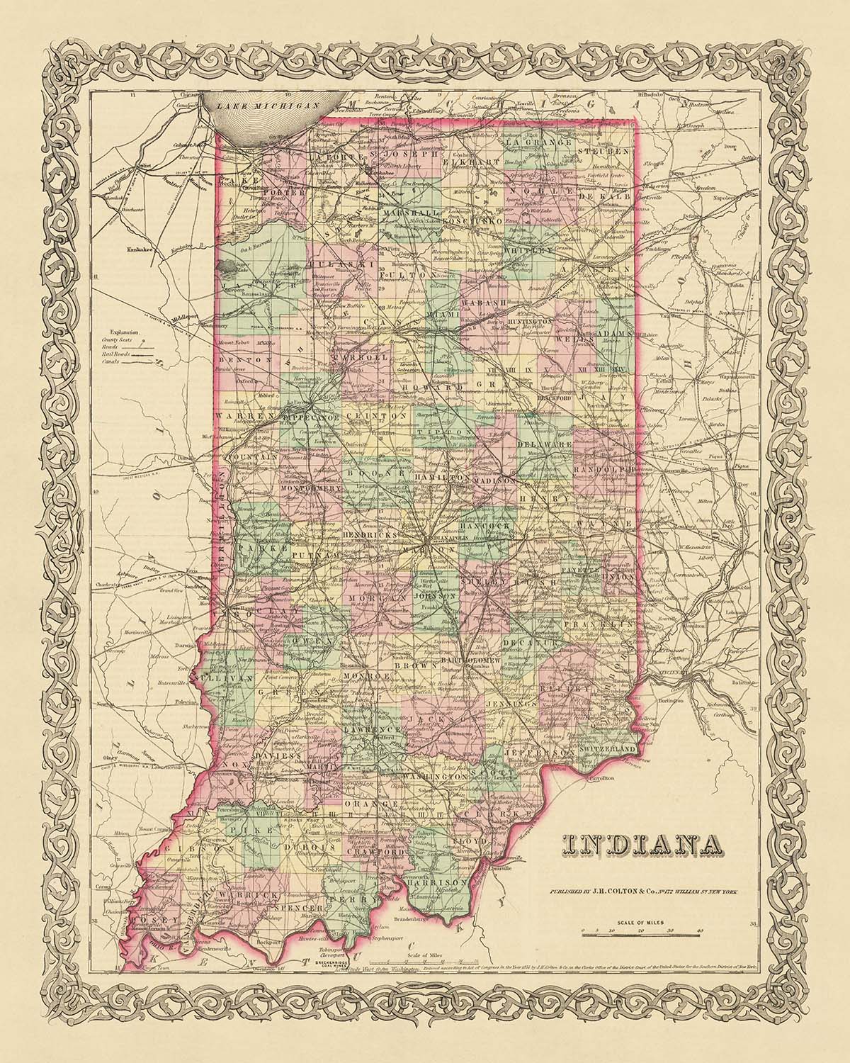
Immerse yourself in the rich history of the United States with this exquisite old map of Indiana, crafted by the renowned mapmaker J.H. Colton in 1855. This piece offers a fascinating glimpse into the early development of the nation, a time when many settlements were yet to be founded and the landscape was in a constant state of flux. As you trace the delicate lines and intricate details of this map, you'll be transported back to a time when the country was still finding its feet and carving out its identity.
This map hails from a period of significant change and growth in the United States. In 1855, Indiana was a burgeoning state, its borders and place names not yet firmly established. The map captures this dynamic period in history, with settlements, rivers, and roads marked out in meticulous detail. The names and borders you see may have changed over the last 150 years, but the spirit of exploration and progress that they represent remains a fundamental part of the American story.
The work of J.H. Colton, widely regarded as the finest American mapmaker of his era, is characterized by his exceptional attention to detail and accuracy. This map is no exception. It features the five most notable settlements in Indiana at the time: Indianapolis, the state capital and a key hub of commerce and transportation; Fort Wayne, a vital outpost on the frontier; New Albany, a thriving river town; Terre Haute, known for its rich natural resources; and Lafayette, a bustling center of trade and industry.
Explore the history of Indiana through this captivating map, and discover the roots of a state that has played a crucial role in the development of the United States. This is more than just a map - it's a piece of history, a work of art, and a testament to the pioneering spirit that shaped a nation.
Notable Settlements in Indiana (Pre-1855)
- Indianapolis (1821): Known as the Crossroads of America, it became the state capital in 1825.
- Fort Wayne (1794): Named after General "Mad" Anthony Wayne, it was a key outpost on the frontier.
- New Albany (1813): A thriving river town, it was the largest city in Indiana until 1860.
- Terre Haute (1816): Known for its rich natural resources, it was an important site for manufacturing and mining.
- Lafayette (1825): A bustling center of trade and industry, it was named after the French General Marquis de Lafayette.
- Vincennes (1732): The oldest continually inhabited European settlement in Indiana, and one of the oldest settlements west of the Appalachians.
- Evansville (1812): Known as the "Crescent City", it was a major stop for steamboats along the Ohio River.
- South Bend (1831): Known for its large indigenous population and later the establishment of the University of Notre Dame.
- Madison (1809): One of the most prosperous industrial cities of the pre-Civil War era, known for its historic architecture.
- Bloomington (1818): Established as a settlement for salt production and later became the home of Indiana University.
- Richmond (1806): Known as the "cradle of recorded jazz" with a rich Quaker history.
- Corydon (1808): The first state capital of Indiana from 1816 to 1825.
- Jeffersonville (1802): A strategic location during the Civil War due to its proximity to Louisville, Kentucky.
- Kokomo (1844): Known as the "City of Firsts" for its significant contributions to the automobile industry.
- Goshen (1831): Known for its rich agricultural history and as a major station on the Underground Railroad.
- Columbus (1821): Noted for its modern architecture and design.
- Anderson (1827): Named after Chief William Anderson, it was a significant site for the natural gas boom of the late 19th century.
- Muncie (1827): Known for the Indiana gas boom and the establishment of Ball State University.
- New Castle (1823): Known for its large earthwork built by the indigenous people of the Hopewell culture.
- Salem (1814): Known for its historic downtown area and the Salem Speedway.
Indigenous Tribes and Territories
- Miami Tribe: Known for their extensive trade network.
- Shawnee Tribe: Known for their resistance against the U.S. in the Tecumseh's War.
- Potawatomi Tribe: Known for their forced removal in the Potawatomi Trail of Death.
- Delaware Tribe: Known for their migration to the region in the 18th century.
Notable Natural Phenomena
- Ohio River: The southern boundary of Indiana, a major waterway for transportation and trade.
- Wabash River: The official river of Indiana, a key part of the state's early transportation network.
- Indiana Dunes: Located along the southern shore of Lake Michigan, a popular tourist attraction today.
- Hoosier National Forest: Known for its scenic beauty and outdoor recreational opportunities.
Historical Events (1810-1855)
- Tecumseh's War (1811): A conflict between the U.S. and an indigenous confederacy led by Tecumseh and his brother Tenskwatawa.
- Indiana Statehood (1816): Indiana was admitted as the 19th U.S. state.
- Construction of the Michigan Road (1830s): The state's first major road, connecting Madison to Michigan City.
- Potawatomi Trail of Death (1838): The forced removal of the Potawatomi people from Indiana to Kansas.
Please double check the images to make sure that a specific town or place is shown on this map. You can also get in touch and ask us to check the map for you.
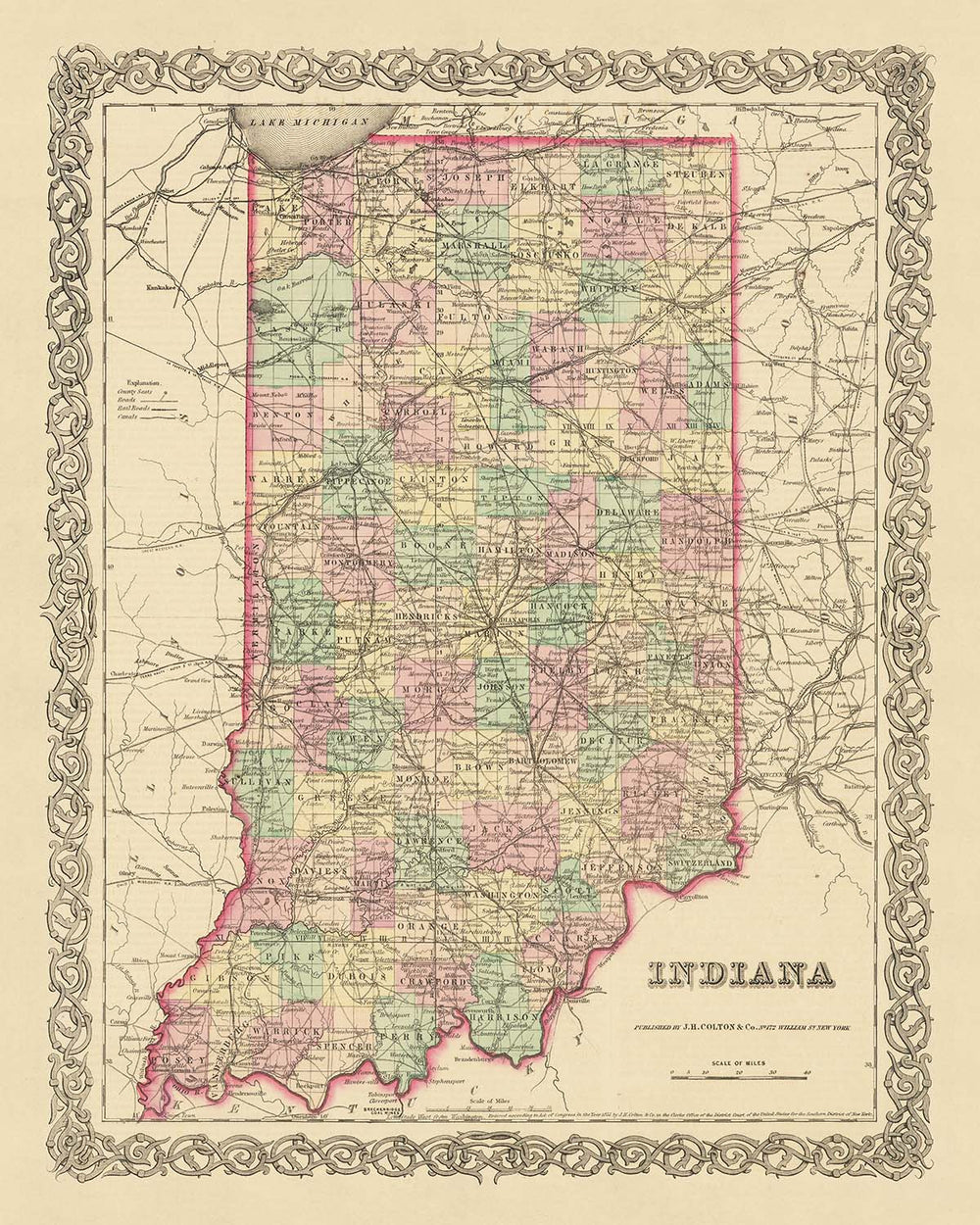
This map looks great at all sizes: 12x16in (30.5x41cm), 16x20in (40.5x51cm), 18x24in (45.5x61cm), 24x30in (61x76cm), 32x40in (81.5x102cm), 40x50in (102x127cm), 48x60in (122x153cm) and 56x70in (142x178cm), but it looks even better when printed large.
I can create beautiful, large prints of this map up to 70in (178cm). Please get in touch if you're looking for larger, customised or different framing options.
The model in the listing images is holding the 16x20in (40.5x51cm) version of this map.
The fifth listing image shows an example of my map personalisation service.
If you’re looking for something slightly different, check out my main collection of USA and North America maps.
Please contact me to check if a certain location, landmark or feature is shown on this map.
This would make a wonderful birthday, Christmas, Father's Day, work leaving, anniversary or housewarming gift for someone from the areas covered by this map.
This map is available as a giclée print on acid free archival matte paper, or you can buy it framed. The frame is a nice, simple black frame that suits most aesthetics. Please get in touch if you'd like a different frame colour or material. My frames are glazed with super-clear museum-grade acrylic (perspex/acrylite), which is significantly less reflective than glass, safer, and will always arrive in perfect condition.
This map is also available as a float framed canvas, sometimes known as a shadow gap framed canvas or canvas floater. The map is printed on artist's cotton canvas and then stretched over a handmade box frame. We then "float" the canvas inside a wooden frame, which is available in a range of colours (black, dark brown, oak, antique gold and white). This is a wonderful way to present a map without glazing in front. See some examples of float framed canvas maps and explore the differences between my different finishes.
For something truly unique, this map is also available in "Unique 3D", our trademarked process that dramatically transforms the map so that it has a wonderful sense of depth. We combine the original map with detailed topography and elevation data, so that mountains and the terrain really "pop". For more info and examples of 3D maps, check my Unique 3D page.
For most orders, delivery time is about 3 working days. Personalised and customised products take longer, as I have to do the personalisation and send it to you for approval, which usually takes 1 or 2 days.
Please note that very large framed orders usually take longer to make and deliver.
If you need your order to arrive by a certain date, please contact me before you order so that we can find the best way of making sure you get your order in time.
I print and frame maps and artwork in 23 countries around the world. This means your order will be made locally, which cuts down on delivery time and ensures that it won't be damaged during delivery. You'll never pay customs or import duty, and we'll put less CO2 into the air.
All of my maps and art prints are well packaged and sent in a rugged tube if unframed, or surrounded by foam if framed.
I try to send out all orders within 1 or 2 days of receiving your order, though some products (like face masks, mugs and tote bags) can take longer to make.
If you select Express Delivery at checkout your order we will prioritise your order and send it out by 1-day courier (Fedex, DHL, UPS, Parcelforce).
Next Day delivery is also available in some countries (US, UK, Singapore, UAE) but please try to order early in the day so that we can get it sent out on time.
My standard frame is a gallery style black ash hardwood frame. It is simple and quite modern looking. My standard frame is around 20mm (0.8in) wide.
I use super-clear acrylic (perspex/acrylite) for the frame glass. It's lighter and safer than glass - and it looks better, as the reflectivity is lower.
Six standard frame colours are available for free (black, dark brown, dark grey, oak, white and antique gold). Custom framing and mounting/matting is available if you're looking for something else.
Most maps, art and illustrations are also available as a framed canvas. We use matte (not shiny) cotton canvas, stretch it over a sustainably sourced box wood frame, and then 'float' the piece within a wood frame. The end result is quite beautiful, and there's no glazing to get in the way.
All frames are provided "ready to hang", with either a string or brackets on the back. Very large frames will have heavy duty hanging plates and/or a mounting baton. If you have any questions, please get in touch.
See some examples of my framed maps and framed canvas maps.
Alternatively, I can also supply old maps and artwork on canvas, foam board, cotton rag and other materials.
If you want to frame your map or artwork yourself, please read my size guide first.
My maps are extremely high quality reproductions of original maps.
I source original, rare maps from libraries, auction houses and private collections around the world, restore them at my London workshop, and then use specialist giclée inks and printers to create beautiful maps that look even better than the original.
My maps are printed on acid-free archival matte (not glossy) paper that feels very high quality and almost like card. In technical terms the paper weight/thickness is 10mil/200gsm. It's perfect for framing.
I print with Epson ultrachrome giclée UV fade resistant pigment inks - some of the best inks you can find.
I can also make maps on canvas, cotton rag and other exotic materials.
Learn more about The Unique Maps Co.
Map personalisation
If you're looking for the perfect anniversary or housewarming gift, I can personalise your map to make it truly unique. For example, I can add a short message, or highlight an important location, or add your family's coat of arms.
The options are almost infinite. Please see my map personalisation page for some wonderful examples of what's possible.
To order a personalised map, select "personalise your map" before adding it to your basket.
Get in touch if you're looking for more complex customisations and personalisations.
Map ageing
I have been asked hundreds of times over the years by customers if they could buy a map that looks even older.
Well, now you can, by selecting Aged before you add a map to your basket.
All the product photos you see on this page show the map in its Original form. This is what the map looks like today.
If you select Aged, I will age your map by hand, using a special and unique process developed through years of studying old maps, talking to researchers to understand the chemistry of aging paper, and of course... lots of practice!
If you're unsure, stick to the Original colour of the map. If you want something a bit darker and older looking, go for Aged.
If you are not happy with your order for any reason, contact me and I'll get it fixed ASAP, free of charge. Please see my returns and refund policy for more information.
I am very confident you will like your restored map or art print. I have been doing this since 1984. I'm a 5-star Etsy seller. I have sold tens of thousands of maps and art prints and have over 5,000 real 5-star reviews. My work has been featured in interior design magazines, on the BBC, and on the walls of dozens of 5-star hotels.
I use a unique process to restore maps and artwork that is massively time consuming and labour intensive. Hunting down the original maps and illustrations can take months. I use state of the art and eye-wateringly expensive technology to scan and restore them. As a result, I guarantee my maps and art prints are a cut above the rest. I stand by my products and will always make sure you're 100% happy with what you receive.
Almost all of my maps and art prints look amazing at large sizes (200cm, 6.5ft+) and I can frame and deliver them to you as well, via special oversized courier. Contact me to discuss your specific needs.
Or try searching for something!


