


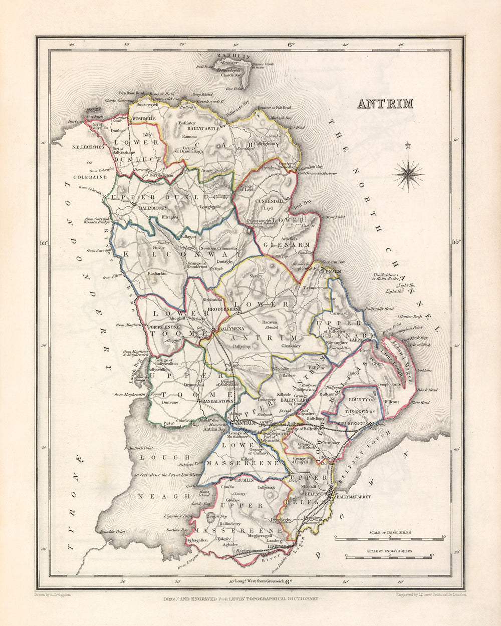
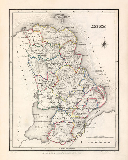


Old Map of County Antrim by Samuel Lewis, 1844: Belfast, Lisburn, Carrickfergus, Ballymena, Giant's Causeway
- All taxes and duties included
- Handmade & dispatched in 1-2 days
-
90 day money back guarantee
ⓘ
90 days to return and refund
Products can be returned within 90 days for a full refund, or exchange for another product.
For personalised and custom made items, we may offer you store credit or a non-expiring gift card, as we cannot resell personalised orders.
If you have any questions, get in touch. For more information, see our full returns & exchanges policy.

My maps are rare, museum-grade, restored old maps sourced from libraries, auction houses and private collections across the globe.
Framing & free personalisation available
1. Select your size
2. Frame & personalise your map
There is limited framing & personalisation capacity available. Order by 10am tomorrow for Christmas delivery.


Gift message & custom finish

If you want to add a gift message, or a finish (jigsaw, aluminium board, etc.) that is not available here, please request it in the "order note" when you check out.
Every order is custom made, so if you need the size adjusted slightly, or printed on an unusual material, just let us know. We've done thousands of custom orders over the years, so there's (almost) nothing we can't manage.
You can also contact us before you order, if you prefer!

- Handmade locally. No import duty or tax
- FREE Delivery by Christmas
- Love it or your money back (90 days)
- Questions? WhatsApp me any time
Own a piece of history
5,000+ 5 star reviews


This Old Map of Antrim by Samuel Lewis in 1844 showcases the historical boundaries of County Antrim, Ireland. It is a fascinating piece of cartographic history that offers a glimpse into the past. The map provides a detailed representation of the region, highlighting the main towns, cities, and other interesting features. Please note that some modern cities may not be present on this map, while others may appear under earlier names, adding an exciting element of discovery. The intricate details and exquisite craftsmanship of this map make it a beautiful addition to any home or office decor.
Notable features on this map include Belfast, the capital and largest city of Northern Ireland, which was already a thriving industrial center in 1844. Lisburn, known for its linen industry, is another prominent town depicted on the map. Carrickfergus, with its impressive castle dating back to the Norman period, adds a touch of medieval charm. Ballymena, a market town known for its connection to the Irish linen industry, is also featured. Last but not least, the iconic Giant's Causeway, a UNESCO World Heritage site renowned for its unique basalt columns, is highlighted on this map.
Here is a list of 30 notable settlements, counties, towns, cities, and colonies that were founded before 1840 and were located within the historical boundaries of County Antrim, Ireland:
- Belfast (1613): The capital and largest city of Northern Ireland, known for its maritime heritage and industrial prowess.
- Lisburn (1609): Famous for its linen industry and historic architecture, including the notable Lisburn Cathedral.
- Carrickfergus (1177): Home to Carrickfergus Castle, a well-preserved Norman fortress overlooking Belfast Lough.
- Ballymena (1626): A market town with strong ties to the Irish linen industry and a rich cultural heritage.
- Giant's Causeway (Legend): A natural wonder renowned for its hexagonal basalt columns, steeped in myth and folklore.
- Antrim (9th century): The historic county town of County Antrim, with a rich history dating back centuries.
- Larne (12th century): A coastal town and seaport known for its picturesque scenery and ferry connections to Scotland.
- Ballycastle (early 17th century): A charming seaside town located on the northeastern coast of County Antrim.
- Portrush (early 17th century): A popular seaside resort town with stunning beaches and renowned golf courses.
- Newtownabbey (early 17th century): A suburban area adjacent to Belfast, offering a mix of urban amenities and natural beauty.
- Carrickfergus Castle (1177): A well-preserved Norman castle, steeped in history and overlooking Belfast Lough.
- Cushendun (early 19th century): A picturesque village nestled at the foot of Glendun, known for its quaint charm.
- Glenarm (12th century): A village with a rich heritage, featuring Glenarm Castle and stunning coastal scenery.
- Randalstown (early 17th century): A small town located on the banks of the River Maine, offering a tranquil setting.
- Crumlin (early 17th century): A village situated on the banks of the River Crumlin, known for its historic mills.
- Toomebridge (early 17th century): A village located on the banks of the River Bann, with a rich industrial past.
- Ahoghill (early 17th century): A village with a strong agricultural tradition and a close-knit community.
- Glenavy (early 17th century): A rural village known for its picturesque surroundings and historic sites.
- Ballyclare (early 17th century): A town with a rich history, offering a mix of modern amenities and traditional charm.
- Doagh (early 17th century): A village renowned for its rural beauty and historical significance.
- Broughshane (early 17th century): A village often referred to as the "Garden Village of Ulster" due to its floral displays.
- Whitehead (early 17th century): A coastal town with a rich maritime heritage and beautiful Victorian architecture.
- Islandmagee (early 17th century): A peninsula known for its stunning coastal cliffs and scenic beauty.
- Templepatrick (early 17th century): A village with a long history, featuring the historic Templepatrick Castle.
- Glenravel (early 17th century): A rural area renowned for its natural beauty, including Glenariff Forest Park.
- Dunloy (early 17th century): A village with a strong sense of community and a rich cultural heritage.
- Clough (early 17th century): A small village nestled in the picturesque countryside of County Antrim.
- Carnlough (early 17th century): A coastal village known for its picturesque harbor and scenic surroundings.
- Cullybackey (early 17th century): A village with a rich history, featuring the historic Arthur Cottage.
- Martinstown (early 17th century): A rural settlement known for its tranquil atmosphere and idyllic landscapes.
Notable boundaries, rivers, canyons, national parks, and natural phenomena in County Antrim, Ireland include:
- River Bann: The longest river in Northern Ireland, flowing through County Antrim and offering scenic beauty.
- River Lagan: A major river that flows through Belfast, connecting the city to Lough Neagh.
- Glens of Antrim: A series of nine picturesque glens that cut through the Antrim Plateau, providing stunning landscapes.
- Antrim Coast Road: A scenic coastal road that winds along the County Antrim coastline, offering breathtaking views.
- Slemish Mountain: A prominent landmark associated with Saint Patrick, offering panoramic views of the surrounding area.
- Cave Hill: A basaltic hill overlooking Belfast, featuring the famous Napoleon's Nose rock formation.
- Glenariff Forest Park: A beautiful forest park located in one of the Glens of Antrim, known for its waterfalls and trails.
- Rathlin Island: An island off the coast of County Antrim, home to diverse wildlife and rugged coastal scenery.
- Carrick-a-Rede Rope Bridge: A famous rope bridge connecting the mainland to Carrick-a-Rede Island, offering thrilling views.
- The Dark Hedges: An enchanting avenue of beech trees, featured in popular TV series and known for its mystical atmosphere.
Notable historical events in County Antrim, Ireland between 1800 and 1850 include:
- The United Irishmen Rebellion (1798): Although preceding the specified timeframe, this rebellion had a significant impact on the region, including County Antrim. It was a major uprising against British rule in Ireland, with battles and skirmishes occurring throughout the country.
- Industrialization and the growth of Belfast: The early 19th century witnessed the rapid industrialization of Belfast, transforming it into a major center for shipbuilding, linen production, and trade. This period marked the city's rise as an industrial powerhouse.
- Famine and emigration: The Great Famine (1845-1852) had a devastating impact on Ireland, including County Antrim. The failure of the potato crop led to widespread hunger, disease, and mass emigration, as people sought better opportunities elsewhere.
Please note that the information provided is based on historical records and may be subject to interpretation and further research.
Please double check the images to make sure that a specific town or place is shown on this map. You can also get in touch and ask us to check the map for you.
This map looks great at all sizes: 12x16in (30.5x41cm), 16x20in (40.5x51cm), 18x24in (45.5x61cm), 24x30in (61x76cm), 32x40in (81.5x102cm) and 40x50in (102x127cm), but it looks even better when printed large.
I can create beautiful, large prints of this map up to 50in (127cm). Please get in touch if you're looking for larger, customised or different framing options.
The model in the listing images is holding the 16x20in (40.5x51cm) version of this map.
The fifth listing image shows an example of my map personalisation service.
If you’re looking for something slightly different, check out my main collection of UK and Ireland maps.
Please contact me to check if a certain location, landmark or feature is shown on this map.
This would make a wonderful birthday, Christmas, Father's Day, work leaving, anniversary or housewarming gift for someone from the areas covered by this map.
This map is available as a giclée print on acid free archival matte paper, or you can buy it framed. The frame is a nice, simple black frame that suits most aesthetics. Please get in touch if you'd like a different frame colour or material. My frames are glazed with super-clear museum-grade acrylic (perspex/acrylite), which is significantly less reflective than glass, safer, and will always arrive in perfect condition.
This map is also available as a float framed canvas, sometimes known as a shadow gap framed canvas or canvas floater. The map is printed on artist's cotton canvas and then stretched over a handmade box frame. We then "float" the canvas inside a wooden frame, which is available in a range of colours (black, dark brown, oak, antique gold and white). This is a wonderful way to present a map without glazing in front. See some examples of float framed canvas maps and explore the differences between my different finishes.
For something truly unique, this map is also available in "Unique 3D", our trademarked process that dramatically transforms the map so that it has a wonderful sense of depth. We combine the original map with detailed topography and elevation data, so that mountains and the terrain really "pop". For more info and examples of 3D maps, check my Unique 3D page.
For most orders, delivery time is about 3 working days. Personalised and customised products take longer, as I have to do the personalisation and send it to you for approval, which usually takes 1 or 2 days.
Please note that very large framed orders usually take longer to make and deliver.
If you need your order to arrive by a certain date, please contact me before you order so that we can find the best way of making sure you get your order in time.
I print and frame maps and artwork in 23 countries around the world. This means your order will be made locally, which cuts down on delivery time and ensures that it won't be damaged during delivery. You'll never pay customs or import duty, and we'll put less CO2 into the air.
All of my maps and art prints are well packaged and sent in a rugged tube if unframed, or surrounded by foam if framed.
I try to send out all orders within 1 or 2 days of receiving your order, though some products (like face masks, mugs and tote bags) can take longer to make.
If you select Express Delivery at checkout your order we will prioritise your order and send it out by 1-day courier (Fedex, DHL, UPS, Parcelforce).
Next Day delivery is also available in some countries (US, UK, Singapore, UAE) but please try to order early in the day so that we can get it sent out on time.
My standard frame is a gallery style black ash hardwood frame. It is simple and quite modern looking. My standard frame is around 20mm (0.8in) wide.
I use super-clear acrylic (perspex/acrylite) for the frame glass. It's lighter and safer than glass - and it looks better, as the reflectivity is lower.
Six standard frame colours are available for free (black, dark brown, dark grey, oak, white and antique gold). Custom framing and mounting/matting is available if you're looking for something else.
Most maps, art and illustrations are also available as a framed canvas. We use matte (not shiny) cotton canvas, stretch it over a sustainably sourced box wood frame, and then 'float' the piece within a wood frame. The end result is quite beautiful, and there's no glazing to get in the way.
All frames are provided "ready to hang", with either a string or brackets on the back. Very large frames will have heavy duty hanging plates and/or a mounting baton. If you have any questions, please get in touch.
See some examples of my framed maps and framed canvas maps.
Alternatively, I can also supply old maps and artwork on canvas, foam board, cotton rag and other materials.
If you want to frame your map or artwork yourself, please read my size guide first.
My maps are extremely high quality reproductions of original maps.
I source original, rare maps from libraries, auction houses and private collections around the world, restore them at my London workshop, and then use specialist giclée inks and printers to create beautiful maps that look even better than the original.
My maps are printed on acid-free archival matte (not glossy) paper that feels very high quality and almost like card. In technical terms the paper weight/thickness is 10mil/200gsm. It's perfect for framing.
I print with Epson ultrachrome giclée UV fade resistant pigment inks - some of the best inks you can find.
I can also make maps on canvas, cotton rag and other exotic materials.
Learn more about The Unique Maps Co.
Map personalisation
If you're looking for the perfect anniversary or housewarming gift, I can personalise your map to make it truly unique. For example, I can add a short message, or highlight an important location, or add your family's coat of arms.
The options are almost infinite. Please see my map personalisation page for some wonderful examples of what's possible.
To order a personalised map, select "personalise your map" before adding it to your basket.
Get in touch if you're looking for more complex customisations and personalisations.
Map ageing
I have been asked hundreds of times over the years by customers if they could buy a map that looks even older.
Well, now you can, by selecting Aged before you add a map to your basket.
All the product photos you see on this page show the map in its Original form. This is what the map looks like today.
If you select Aged, I will age your map by hand, using a special and unique process developed through years of studying old maps, talking to researchers to understand the chemistry of aging paper, and of course... lots of practice!
If you're unsure, stick to the Original colour of the map. If you want something a bit darker and older looking, go for Aged.
If you are not happy with your order for any reason, contact me and I'll get it fixed ASAP, free of charge. Please see my returns and refund policy for more information.
I am very confident you will like your restored map or art print. I have been doing this since 1984. I'm a 5-star Etsy seller. I have sold tens of thousands of maps and art prints and have over 5,000 real 5-star reviews. My work has been featured in interior design magazines, on the BBC, and on the walls of dozens of 5-star hotels.
I use a unique process to restore maps and artwork that is massively time consuming and labour intensive. Hunting down the original maps and illustrations can take months. I use state of the art and eye-wateringly expensive technology to scan and restore them. As a result, I guarantee my maps and art prints are a cut above the rest. I stand by my products and will always make sure you're 100% happy with what you receive.
Almost all of my maps and art prints look amazing at large sizes (200cm, 6.5ft+) and I can frame and deliver them to you as well, via special oversized courier. Contact me to discuss your specific needs.
Or try searching for something!


