

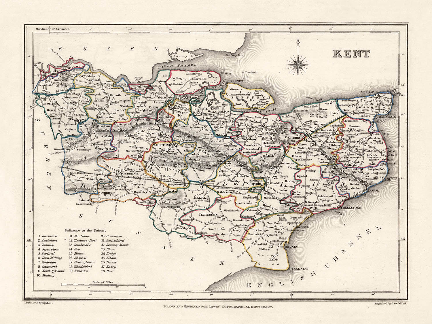


Old Map of Kent by Samuel Lewis, 1844: Maidstone, Gillingham, Ashford, Royal Tunbridge Wells, and Margate
- All taxes and duties included
- Handmade & dispatched in 1-2 days
-
90 day money back guarantee
ⓘ
90 days to return and refund
Products can be returned within 90 days for a full refund, or exchange for another product.
For personalised and custom made items, we may offer you store credit or a non-expiring gift card, as we cannot resell personalised orders.
If you have any questions, get in touch. For more information, see our full returns & exchanges policy.

My maps are rare, museum-grade, restored old maps sourced from libraries, auction houses and private collections across the globe.
Framing & free personalisation available
1. Select your size
2. Frame & personalise your map
There is limited framing & personalisation capacity available. Order soon for Christmas delivery.


Gift message & custom finish

If you want to add a gift message, or a finish (jigsaw, aluminium board, etc.) that is not available here, please request it in the "order note" when you check out.
Every order is custom made, so if you need the size adjusted slightly, or printed on an unusual material, just let us know. We've done thousands of custom orders over the years, so there's (almost) nothing we can't manage.
You can also contact us before you order, if you prefer!

- Handmade locally. No import duty or tax
- FREE Delivery by Christmas
- Love it or your money back (90 days)
- Questions? WhatsApp me any time
Own a piece of history
5,000+ 5 star reviews


Discover the historical grandeur of Kent through Samuel Lewis' meticulously crafted 1844 map, a treasure to behold for both history enthusiasts and cartography connoisseurs. This antiquated depiction of one of England's oldest and most influential counties captures the essence of the past, showcasing settlements that predate 1840, including many of today's bustling cities. As such, it paints a fascinating picture of an era when some of today's most prominent towns and cities were just forming or, excitingly, were known by different names.
One of the most significant features of this map is its ability to transport you back in time to a Kent that is as familiar as it is foreign. Each detail has been preserved, from the delicate penmanship denoting town names, to the artful sketching of the county's boundaries and natural features. This 1844 map encapsulates a period of critical transition and development within Kent and serves as a tangible connection to the past, reminding us of the enduring foundation upon which the present is built.
Featured Settlements:
- Maidstone (Founded around AD 975): Today's county town of Kent, Maidstone boasts of rich history reflected in its stunning architecture, including the Maidstone Museum and the Leeds Castle.
- Gillingham (Founded in the 13th Century): The Royal Engineers Museum in Gillingham documents the town's military engineering history.
- Ashford (Founded around AD 500): Famous for the Ashford Designer Outlet, the town also holds an important position in Kent's railway history.
- Royal Tunbridge Wells (Founded in the 17th Century): Known for the Chalybeate Spring, it became a popular spa town in the Georgian Era.
- Margate (Founded in the 13th Century): Known for its sandy beaches, Margate was one of the early English seaside resorts.
- Dover (Founded around 1st Century BC): Known for the White Cliffs of Dover and Dover Castle, one of the largest castles in England.
- Canterbury (Founded in the 1st Century AD): Canterbury, with its cathedral, is one of the most famous Christian pilgrimage sites in the world.
- Folkestone (Founded in the 7th Century): Known for the Lower Leas Coastal Park and Folkestone Harbour Arm.
- Sittingbourne (Founded in the Middle Ages): An industrial town famous for brick-making and paper production.
- Gravesend (Founded in the 10th Century): Known for the Pocahontas statue at St. George's Church, where she was buried in 1617.
- Herne Bay (Founded in the early 19th Century): Known for its Victorian architecture and beautiful bay.
- Faversham (Founded in the 1st Century AD): Known for the country's oldest brewery, Shepherd Neame.
- Whitstable (Founded before the 10th Century): Famous for its oysters, celebrated in the annual Whitstable Oyster Festival.
- Tonbridge (Founded in the 11th Century): Tonbridge Castle is a notable landmark in this town.
- Sevenoaks (Founded in the 13th Century): Named after seven oak trees in Knole Park, it's home to the National Trust property Knole House.
- Dartford (Founded in the Roman era): Known for its association with the paper-making industry and Mick Jagger of the Rolling Stones.
- Deal (Founded in the 13th Century): Known for its Georgian architecture and Deal Castle, built by Henry VIII.
- Ramsgate (Founded in the early 19th Century): Known for its marina, beaches, and the only 'Royal' Harbour in the United Kingdom.
- Rochester (Founded in AD 604): Known for the Rochester Cathedral and Rochester Castle.
- Broadstairs (Founded in the 11th Century): Known for its sandy beaches and the annual Dickens Festival.
- Hythe (Founded in the 8th Century): Known for the Medieval and Georgian buildings in the town centre.
- Sandwich (Founded in the 7th Century): Known for its well-preserved medieval buildings.
- Tenterden (Founded in the 13th Century): Known for the Chapel Down Winery and the Kent and East Sussex Railway.
- Paddock Wood (Founded in the early 19th Century): Known for the Hop Farm Country Park.
- Cranbrook (Founded in the 13th Century): Known for the Union Windmill, the tallest surviving "smock mill" in the British Isles.
- New Romney (Founded in the 8th Century): Once a sea port, now located more than a mile from the sea.
- Edenbridge (Founded in the Roman era): Known for the Hever Castle, the childhood home of Anne Boleyn.
- Snodland (Founded in the Roman era): Known for its paper production history.
- Strood (Founded in the Roman era): Known for the Temple Manor, a 13th-century Knights Templar building.
- Swanley (Founded in the 19th Century): Known for the Swanley Park, a popular local attraction.
Notable Natural Phenomena & Attractions:
- The White Cliffs of Dover: An iconic natural feature that has stood as a symbol of Britain for centuries.
- River Medway: Kent's principal river, which has been a key trading route and offers beautiful walks.
- The North Downs: An area of outstanding natural beauty with a variety of walking routes.
- The Weald of Kent: A historical region filled with ancient woods and scenic landscapes.
- The Romney Marsh: Known for its unique natural beauty, it is one of the last wildernesses in southern England.
Historical Events (1800-1850):
- The Battle of Bossenden Wood (1838): A small-scale skirmish in Kent during a period of political unrest, it's the last battle on English soil.
- The Swing Riots (1830): Agricultural labourers across southern England, including Kent, protested against their worsening conditions.
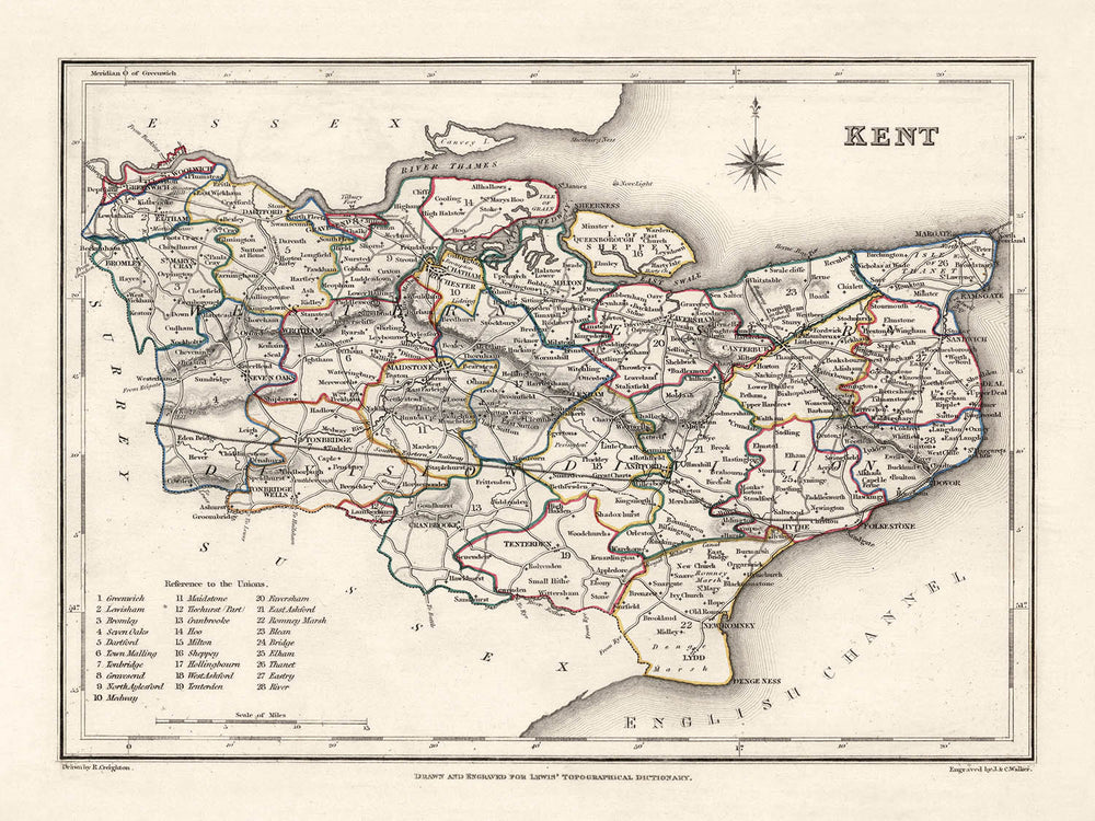
Please double check the images to make sure that a specific town or place is shown on this map. You can also get in touch and ask us to check the map for you.
This map looks great at all sizes: 8x10in (20.5x25.5cm), 12x16in (30.5x41cm), 18x24in (45.5x61cm), 16x20in (40.5x51cm), 24x36in (61x91.5cm), 30x40in (76x101.5cm) and 37x50in (94x127cm), but it looks even better when printed large.
I can create beautiful, large prints of this map up to 50in (127cm). Please get in touch if you're looking for larger, customised or different framing options.
The model in the listing images is holding the 18x24in (45.5x61cm) version of this map.
The fifth listing image shows an example of my map personalisation service.
If you’re looking for something slightly different, check out my main collection of UK and Ireland maps.
Please contact me to check if a certain location, landmark or feature is shown on this map.
This would make a wonderful birthday, Christmas, Father's Day, work leaving, anniversary or housewarming gift for someone from the areas covered by this map.
This map is available as a giclée print on acid free archival matte paper, or you can buy it framed. The frame is a nice, simple black frame that suits most aesthetics. Please get in touch if you'd like a different frame colour or material. My frames are glazed with super-clear museum-grade acrylic (perspex/acrylite), which is significantly less reflective than glass, safer, and will always arrive in perfect condition.
This map is also available as a float framed canvas, sometimes known as a shadow gap framed canvas or canvas floater. The map is printed on artist's cotton canvas and then stretched over a handmade box frame. We then "float" the canvas inside a wooden frame, which is available in a range of colours (black, dark brown, oak, antique gold and white). This is a wonderful way to present a map without glazing in front. See some examples of float framed canvas maps and explore the differences between my different finishes.
For something truly unique, this map is also available in "Unique 3D", our trademarked process that dramatically transforms the map so that it has a wonderful sense of depth. We combine the original map with detailed topography and elevation data, so that mountains and the terrain really "pop". For more info and examples of 3D maps, check my Unique 3D page.
For most orders, delivery time is about 3 working days. Personalised and customised products take longer, as I have to do the personalisation and send it to you for approval, which usually takes 1 or 2 days.
Please note that very large framed orders usually take longer to make and deliver.
If you need your order to arrive by a certain date, please contact me before you order so that we can find the best way of making sure you get your order in time.
I print and frame maps and artwork in 23 countries around the world. This means your order will be made locally, which cuts down on delivery time and ensures that it won't be damaged during delivery. You'll never pay customs or import duty, and we'll put less CO2 into the air.
All of my maps and art prints are well packaged and sent in a rugged tube if unframed, or surrounded by foam if framed.
I try to send out all orders within 1 or 2 days of receiving your order, though some products (like face masks, mugs and tote bags) can take longer to make.
If you select Express Delivery at checkout your order we will prioritise your order and send it out by 1-day courier (Fedex, DHL, UPS, Parcelforce).
Next Day delivery is also available in some countries (US, UK, Singapore, UAE) but please try to order early in the day so that we can get it sent out on time.
My standard frame is a gallery style black ash hardwood frame. It is simple and quite modern looking. My standard frame is around 20mm (0.8in) wide.
I use super-clear acrylic (perspex/acrylite) for the frame glass. It's lighter and safer than glass - and it looks better, as the reflectivity is lower.
Six standard frame colours are available for free (black, dark brown, dark grey, oak, white and antique gold). Custom framing and mounting/matting is available if you're looking for something else.
Most maps, art and illustrations are also available as a framed canvas. We use matte (not shiny) cotton canvas, stretch it over a sustainably sourced box wood frame, and then 'float' the piece within a wood frame. The end result is quite beautiful, and there's no glazing to get in the way.
All frames are provided "ready to hang", with either a string or brackets on the back. Very large frames will have heavy duty hanging plates and/or a mounting baton. If you have any questions, please get in touch.
See some examples of my framed maps and framed canvas maps.
Alternatively, I can also supply old maps and artwork on canvas, foam board, cotton rag and other materials.
If you want to frame your map or artwork yourself, please read my size guide first.
My maps are extremely high quality reproductions of original maps.
I source original, rare maps from libraries, auction houses and private collections around the world, restore them at my London workshop, and then use specialist giclée inks and printers to create beautiful maps that look even better than the original.
My maps are printed on acid-free archival matte (not glossy) paper that feels very high quality and almost like card. In technical terms the paper weight/thickness is 10mil/200gsm. It's perfect for framing.
I print with Epson ultrachrome giclée UV fade resistant pigment inks - some of the best inks you can find.
I can also make maps on canvas, cotton rag and other exotic materials.
Learn more about The Unique Maps Co.
Map personalisation
If you're looking for the perfect anniversary or housewarming gift, I can personalise your map to make it truly unique. For example, I can add a short message, or highlight an important location, or add your family's coat of arms.
The options are almost infinite. Please see my map personalisation page for some wonderful examples of what's possible.
To order a personalised map, select "personalise your map" before adding it to your basket.
Get in touch if you're looking for more complex customisations and personalisations.
Map ageing
I have been asked hundreds of times over the years by customers if they could buy a map that looks even older.
Well, now you can, by selecting Aged before you add a map to your basket.
All the product photos you see on this page show the map in its Original form. This is what the map looks like today.
If you select Aged, I will age your map by hand, using a special and unique process developed through years of studying old maps, talking to researchers to understand the chemistry of aging paper, and of course... lots of practice!
If you're unsure, stick to the Original colour of the map. If you want something a bit darker and older looking, go for Aged.
If you are not happy with your order for any reason, contact me and I'll get it fixed ASAP, free of charge. Please see my returns and refund policy for more information.
I am very confident you will like your restored map or art print. I have been doing this since 1984. I'm a 5-star Etsy seller. I have sold tens of thousands of maps and art prints and have over 5,000 real 5-star reviews. My work has been featured in interior design magazines, on the BBC, and on the walls of dozens of 5-star hotels.
I use a unique process to restore maps and artwork that is massively time consuming and labour intensive. Hunting down the original maps and illustrations can take months. I use state of the art and eye-wateringly expensive technology to scan and restore them. As a result, I guarantee my maps and art prints are a cut above the rest. I stand by my products and will always make sure you're 100% happy with what you receive.
Almost all of my maps and art prints look amazing at large sizes (200cm, 6.5ft+) and I can frame and deliver them to you as well, via special oversized courier. Contact me to discuss your specific needs.
Or try searching for something!


