

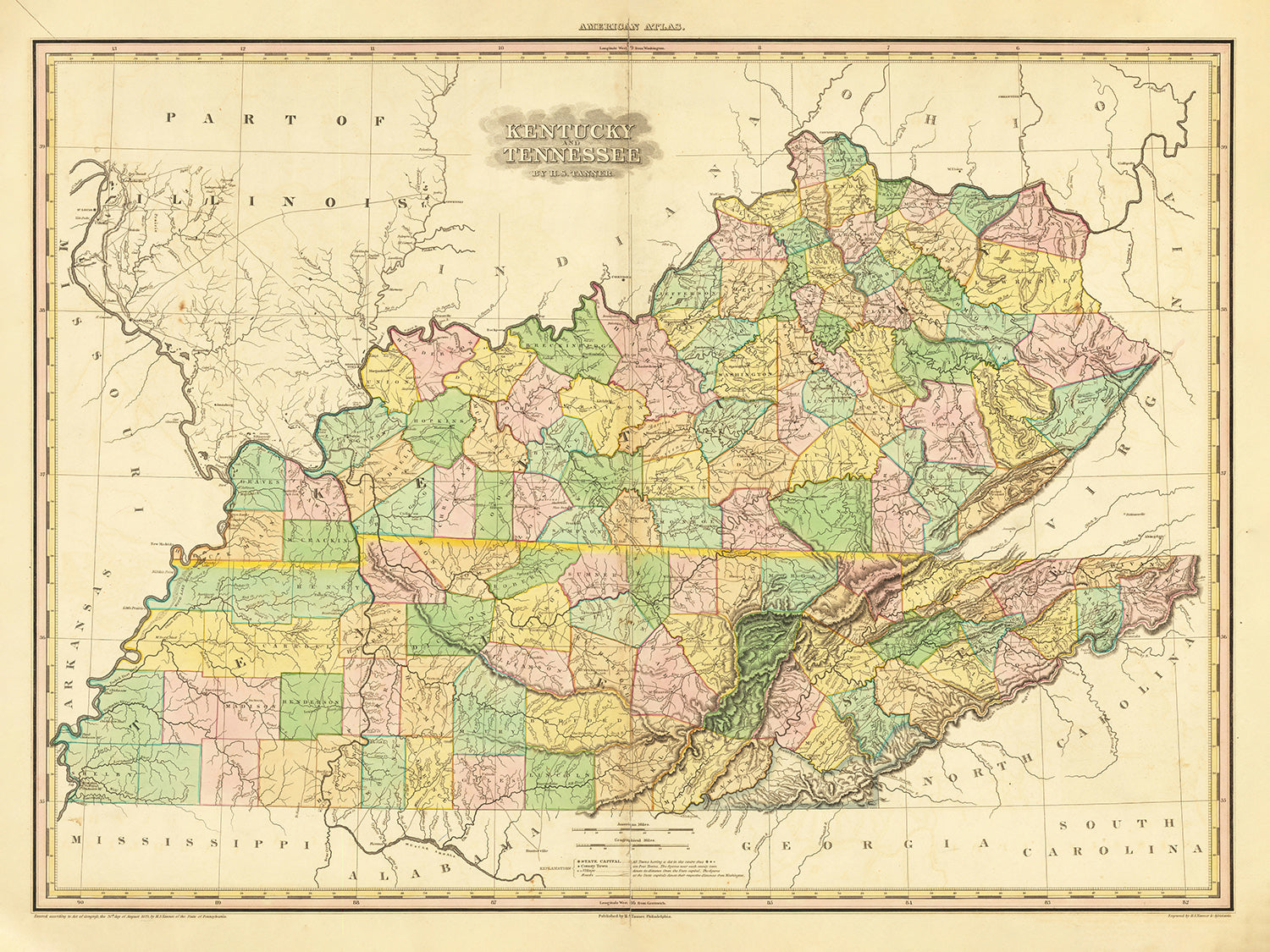


Old Map of Kentucky and Tennessee by H.S. Tanner, 1820, featuring Nashville, Louisville, Lexington, Knoxville, and Chattanooga
- All taxes and duties included
- Handmade & dispatched in 1-2 days
-
90 day money back guarantee
ⓘ
90 days to return and refund
Products can be returned within 90 days for a full refund, or exchange for another product.
For personalised and custom made items, we may offer you store credit or a non-expiring gift card, as we cannot resell personalised orders.
If you have any questions, get in touch. For more information, see our full returns & exchanges policy.

My maps are rare, museum-grade, restored old maps sourced from libraries, auction houses and private collections across the globe.
Framing & free personalisation available
1. Select your size
2. Frame & personalise your map
Make your map unique with framing, hand-drawn customisation, vintage ageing, pop art text, unique 3D styling and moreGift message & custom finish

If you want to add a gift message, or a finish (jigsaw, aluminium board, etc.) that is not available here, please request it in the "order note" when you check out.
Every order is custom made, so if you need the size adjusted slightly, or printed on an unusual material, just let us know. We've done thousands of custom orders over the years, so there's (almost) nothing we can't manage.
You can also contact us before you order, if you prefer!
Order by 10am tomorrow for free Christmas delivery

- Handmade locally. No import duty or tax
- FREE Delivery. Arrives in 2-3 days
- Love it or your money back
- Questions? WhatsApp me any time
Own a piece of history
5,000+ 5 star reviews


Immerse yourself in the charm of the past with this exquisite 1820 map of Kentucky and Tennessee by H. S. Tanner. An invaluable piece of history, this map offers a window into a formative era in the development of these significant regions. Crafted with an exquisite eye for detail and a deep understanding of geography, this antique piece is more than a map - it's a vibrant tapestry woven with the threads of early American history.
As a cherished relic from the past, this map highlights an array of settlements that contributed to the richness of Kentucky and Tennessee's history. Each place marked on this map tells a story of its own, with some being centers of trade, seats of power, or hubs of cultural assimilation.
Key settlements in Kentucky include:
- Louisville (1778): Founded by George Rogers Clark, it's one of the oldest cities west of the Appalachian Mountains.
- Lexington (1775): Founded in 1775, Lexington was named in honor of the Battles of Lexington and Concord in Massachusetts.
- Frankfort (1786): Known for being the state capital and for its historical downtown.
- Paducah (1827): Recognized for its strategic location at the confluence of the Tennessee and the Ohio rivers.
- Owensboro (1817): Known for its vibrant bluegrass music scene and rich barbecue culture.
- Bowling Green (1798): Known for its historical significance during the Civil War.
- Covington (1815): Famous for its well-preserved historic districts.
- Hopkinsville (1796): Known for its annual 'Little Green Men' festival celebrating a claimed alien encounter in 1955.
- Richmond (1798): Known for the Battle of Richmond during the Civil War.
- Madisonville (1807): Known for its rich coal mining history.
- Elizabethtown (1797): Notable for being a gateway to the Bourbon Trail.
- Cumberland (1826): Named after the Cumberland River, it is known for its historic coal mining industry.
- Glasgow (1799): Known for its annual Scottish Highland Games.
- Pikeville (1822): Known for the historic feud between the Hatfield and McCoy families.
- Berea (1855): Notable for Berea College, the first co-educational and racially integrated college in the South.
Key settlements in Tennessee include:
- Nashville (1779): Known as the "Music City," it was founded by James Robertson and John Donelson and served as a major location for the music industry, especially country music.
- Knoxville (1791): This city is notable as the first capital of Tennessee.
- Chattanooga (1816): Chattanooga was an important city for its railroads which played a significant part in the Civil War.
- Clarksville (1785): Named for Revolutionary War hero General George Rogers Clark.
- Jackson (1821): Named after President Andrew Jackson, this city was a center for the railroad industry in the 19th century.
- Murfreesboro (1811): Was the capital of Tennessee from 1818 to 1826.
- Bristol (1852): Recognized as the birthplace of country music.
- Gallatin (1802): Notable for its numerous prehistoric sites and historic plantations.
- Lebanon (1801): Famous for its Wilson County Fair, one of the largest in Tennessee.
- Smyrna (1819): Known for its rich Civil War history.
- Greeneville (1783): Notable as the home of President Andrew Johnson.
- Sevierville (1795): Known for being the hometown of Dolly Parton.
- Shelbyville (1810): Known as the "Walking Horse Capital of the World."
Notable natural features include:
- Cumberland Gap: A pass through the Cumberland Mountains used by Native Americans and early settlers, and now part of the Cumberland Gap National Historical Park.
- Mammoth Cave: The longest cave system known in the world, located in central Kentucky, and a popular tourist attraction.
- Great Smoky Mountains: The mountain range lining the Tennessee-North Carolina border, home to the Great Smoky Mountains National Park, the most visited national park in the United States.
- Kentucky River: The major waterway in central Kentucky, known for its beautiful palisades.
In the timeframe of 1815-1820, the region experienced significant developments such as:
- The charter of Transylvania University in Lexington, Kentucky in 1818.
- The admission of Illinois to the Union in 1818, redefining the northern boundary of Kentucky.
- The establishment of the Western and Atlantic Railroad in Chattanooga, Tennessee in 1836, which would become a critical logistical point in the American Civil War.
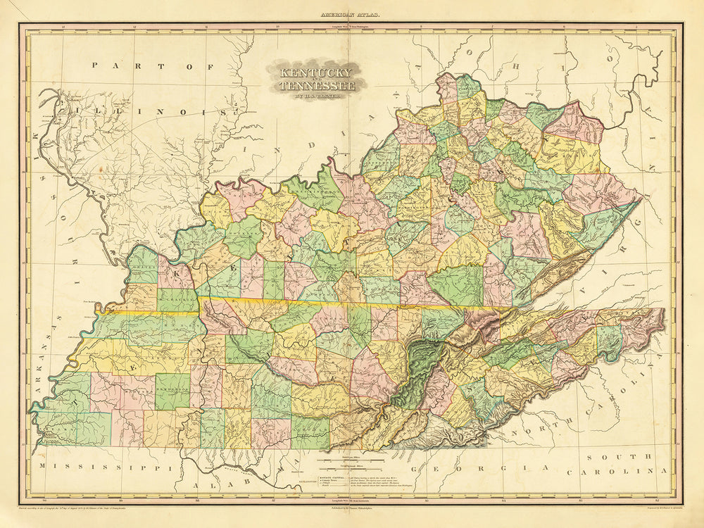
Immerse yourself in a bygone era with this beautifully detailed old map of Kentucky and Tennessee by H. S. Tanner. With its intricate renderings of settlements and topographical features, this map invites you on a journey through history, capturing a pivotal time in the early days of these two vibrant states. Explore the past, admire the artistry, and cherish the stories etched into this rare and precious piece of American heritage.
Please double check the images to make sure that a specific town or place is shown on this map. You can also get in touch and ask us to check the map for you.
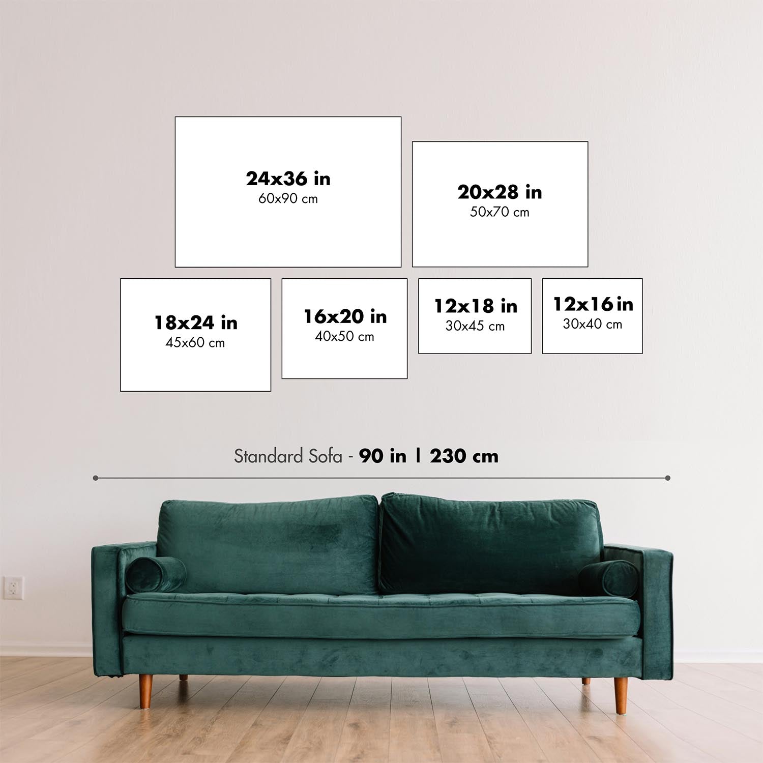
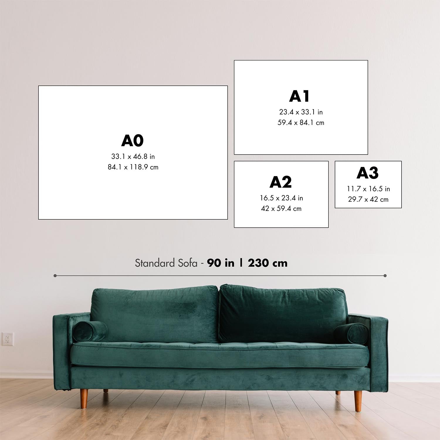
This map looks great at all sizes: 12x16in (30.5x41cm), 18x24in (45.5x61cm), 16x20in (40.5x51cm), 24x36in (61x91.5cm), 30x40in (76x101.5cm), 37x50in (94x127cm), 45x60in (114x152.5cm) and 52x70in (132x178cm), but it looks even better when printed large.
I can create beautiful, large prints of this map up to 100in (254cm). Please get in touch if you're looking for larger, customised or different framing options.
The model in the listing images is holding the 18x24in (45.5x61cm) version of this map.
The fifth listing image shows an example of my map personalisation service.
If you’re looking for something slightly different, check out my main collection of USA and North America maps.
Please contact me to check if a certain location, landmark or feature is shown on this map.
This would make a wonderful birthday, Christmas, Father's Day, work leaving, anniversary or housewarming gift for someone from the areas covered by this map.
This map is available as a giclée print on acid free archival matte paper, or you can buy it framed. The frame is a nice, simple black frame that suits most aesthetics. Please get in touch if you'd like a different frame colour or material. My frames are glazed with super-clear museum-grade acrylic (perspex/acrylite), which is significantly less reflective than glass, safer, and will always arrive in perfect condition.
This map is also available as a float framed canvas, sometimes known as a shadow gap framed canvas or canvas floater. The map is printed on artist's cotton canvas and then stretched over a handmade box frame. We then "float" the canvas inside a wooden frame, which is available in a range of colours (black, dark brown, oak, antique gold and white). This is a wonderful way to present a map without glazing in front. See some examples of float framed canvas maps and explore the differences between my different finishes.
For something truly unique, this map is also available in "Unique 3D", our trademarked process that dramatically transforms the map so that it has a wonderful sense of depth. We combine the original map with detailed topography and elevation data, so that mountains and the terrain really "pop". For more info and examples of 3D maps, check my Unique 3D page.
For most orders, delivery time is about 3 working days. Personalised and customised products take longer, as I have to do the personalisation and send it to you for approval, which usually takes 1 or 2 days.
Please note that very large framed orders usually take longer to make and deliver.
If you need your order to arrive by a certain date, please contact me before you order so that we can find the best way of making sure you get your order in time.
I print and frame maps and artwork in 23 countries around the world. This means your order will be made locally, which cuts down on delivery time and ensures that it won't be damaged during delivery. You'll never pay customs or import duty, and we'll put less CO2 into the air.
All of my maps and art prints are well packaged and sent in a rugged tube if unframed, or surrounded by foam if framed.
I try to send out all orders within 1 or 2 days of receiving your order, though some products (like face masks, mugs and tote bags) can take longer to make.
If you select Express Delivery at checkout your order we will prioritise your order and send it out by 1-day courier (Fedex, DHL, UPS, Parcelforce).
Next Day delivery is also available in some countries (US, UK, Singapore, UAE) but please try to order early in the day so that we can get it sent out on time.
My standard frame is a gallery style black ash hardwood frame. It is simple and quite modern looking. My standard frame is around 20mm (0.8in) wide.
I use super-clear acrylic (perspex/acrylite) for the frame glass. It's lighter and safer than glass - and it looks better, as the reflectivity is lower.
Six standard frame colours are available for free (black, dark brown, dark grey, oak, white and antique gold). Custom framing and mounting/matting is available if you're looking for something else.
Most maps, art and illustrations are also available as a framed canvas. We use matte (not shiny) cotton canvas, stretch it over a sustainably sourced box wood frame, and then 'float' the piece within a wood frame. The end result is quite beautiful, and there's no glazing to get in the way.
All frames are provided "ready to hang", with either a string or brackets on the back. Very large frames will have heavy duty hanging plates and/or a mounting baton. If you have any questions, please get in touch.
See some examples of my framed maps and framed canvas maps.
Alternatively, I can also supply old maps and artwork on canvas, foam board, cotton rag and other materials.
If you want to frame your map or artwork yourself, please read my size guide first.
My maps are extremely high quality reproductions of original maps.
I source original, rare maps from libraries, auction houses and private collections around the world, restore them at my London workshop, and then use specialist giclée inks and printers to create beautiful maps that look even better than the original.
My maps are printed on acid-free archival matte (not glossy) paper that feels very high quality and almost like card. In technical terms the paper weight/thickness is 10mil/200gsm. It's perfect for framing.
I print with Epson ultrachrome giclée UV fade resistant pigment inks - some of the best inks you can find.
I can also make maps on canvas, cotton rag and other exotic materials.
Learn more about The Unique Maps Co.
Map personalisation
If you're looking for the perfect anniversary or housewarming gift, I can personalise your map to make it truly unique. For example, I can add a short message, or highlight an important location, or add your family's coat of arms.
The options are almost infinite. Please see my map personalisation page for some wonderful examples of what's possible.
To order a personalised map, select "personalise your map" before adding it to your basket.
Get in touch if you're looking for more complex customisations and personalisations.
Map ageing
I have been asked hundreds of times over the years by customers if they could buy a map that looks even older.
Well, now you can, by selecting Aged before you add a map to your basket.
All the product photos you see on this page show the map in its Original form. This is what the map looks like today.
If you select Aged, I will age your map by hand, using a special and unique process developed through years of studying old maps, talking to researchers to understand the chemistry of aging paper, and of course... lots of practice!
If you're unsure, stick to the Original colour of the map. If you want something a bit darker and older looking, go for Aged.
If you are not happy with your order for any reason, contact me and I'll get it fixed ASAP, free of charge. Please see my returns and refund policy for more information.
I am very confident you will like your restored map or art print. I have been doing this since 1984. I'm a 5-star Etsy seller. I have sold tens of thousands of maps and art prints and have over 5,000 real 5-star reviews. My work has been featured in interior design magazines, on the BBC, and on the walls of dozens of 5-star hotels.
I use a unique process to restore maps and artwork that is massively time consuming and labour intensive. Hunting down the original maps and illustrations can take months. I use state of the art and eye-wateringly expensive technology to scan and restore them. As a result, I guarantee my maps and art prints are a cut above the rest. I stand by my products and will always make sure you're 100% happy with what you receive.
Almost all of my maps and art prints look amazing at large sizes (200cm, 6.5ft+) and I can frame and deliver them to you as well, via special oversized courier. Contact me to discuss your specific needs.
Or try searching for something!


