

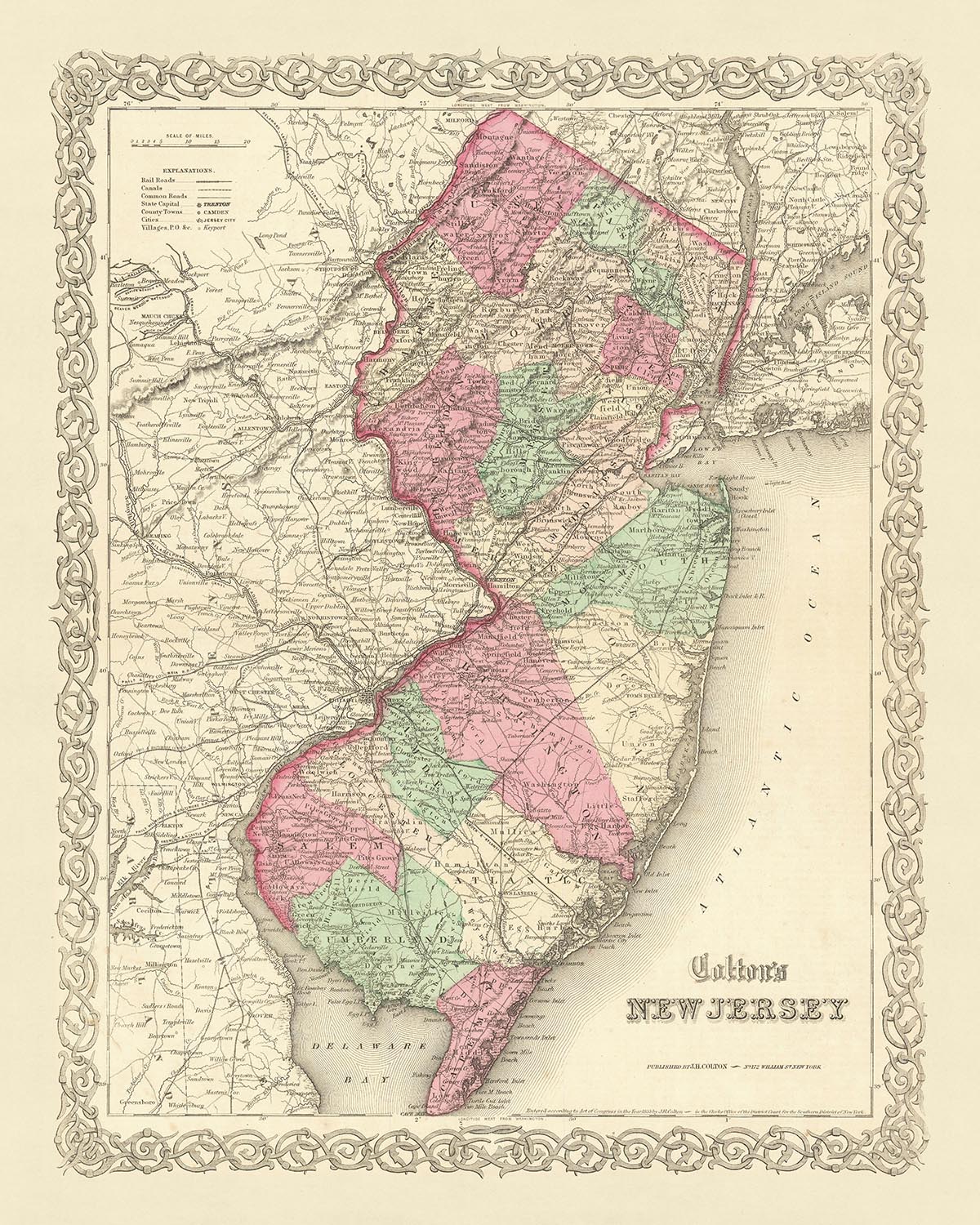


Old Map of New Jersey by J. H. Colton, 1855: Newark, Jersey City, Paterson, Trenton, and Camden
- All taxes and duties included
- Handmade & dispatched in 1-2 days
-
90 day money back guarantee
ⓘ
90 days to return and refund
Products can be returned within 90 days for a full refund, or exchange for another product.
For personalised or custom made items, we may offer you store credit or a non-expiring gift card, as we cannot resell personalised orders.
If you have any questions, get in touch. For more information, see our full returns & exchanges policy.

My maps are rare, museum-grade, restored old maps sourced from libraries, auction houses and private collections across the globe.
Framing & free personalisation available
1. Select your size
2. Frame & personalise your map
Make your map unique with framing, hand-drawn customisation, vintage ageing, pop art text, unique 3D styling and moreGift message & custom finish

If you want to add a gift message, or a finish (jigsaw, aluminium board, etc.) that is not available here, please request it in the "order note" when you check out.
Every order is custom made, so if you need the size adjusted slightly, or printed on an unusual material, just let us know. We've done thousands of custom orders over the years, so there's (almost) nothing we can't manage.
You can also contact us before you order, if you prefer!

- Handmade locally. No import duty or tax
- FREE Delivery. Arrives in 2-3 days
- Love it or your money back
- Questions? WhatsApp me any time
Own a piece of history
5,000+ 5 star reviews


Immerse yourself in the rich history of the United States with this exquisite 1855 map of New Jersey, crafted by the renowned mapmaker J. H. Colton. This piece is a testament to the early days of American cartography, capturing the Garden State in a time when many of its settlements were still in their infancy. The map showcases the meticulous craftsmanship and attention to detail that have solidified Colton's reputation as one of the finest American mapmakers of his era.
This map offers a fascinating snapshot of New Jersey in the mid-19th century, a period when the United States was still in its early stages of development. Many of the settlements that we know today had not yet been founded, and the names and borders that are familiar to us now have undergone significant changes over the past 150 years. This makes the map not only a beautiful piece of art, but also a valuable historical document that provides insight into the evolution of the American landscape.
The map features the five most notable settlements in New Jersey in 1855: Newark, Jersey City, Paterson, Trenton, and Camden. Each of these cities has its own unique history and played a significant role in shaping the state as we know it today. Whether you're a history enthusiast, a lover of maps, or simply someone who appreciates fine craftsmanship, this map is sure to captivate your interest and spark your curiosity about the past.
Dive into the rich tapestry of American history with this exceptional piece. It's more than just a map - it's a journey back in time, a window into a bygone era, and a testament to the skill and artistry of one of America's finest mapmakers. Add this stunning piece to your collection and let it serve as a constant reminder of the ever-changing nature of our world and the enduring beauty of the art of cartography.
Notable Settlements in New Jersey
- Newark (1666): Originally founded by Puritans from Connecticut, Newark is the most populous city in New Jersey. It was known as "New Ark" or "New Work" in its early years.
- Jersey City (1660): Originally settled by the Dutch, it was known as Paulus Hook before becoming Jersey City. It played a significant role in the Revolutionary War.
- Paterson (1792): Known as the "Silk City" for its dominant role in silk production during the 19th century.
- Trenton (1719): The state capital, it was the site of the Battle of Trenton during the Revolutionary War.
- Camden (1828): A significant industrial city during the 19th century, it was the home of the first phonograph records.
- Elizabeth (1664): Originally called Elizabethtown, it was the first capital of New Jersey.
- New Brunswick (1730): Home to Rutgers University, the eighth-oldest college in the United States.
- Hackensack (1665): Originally a Dutch settlement known as New Barbadoes.
- Morristown (1715): Known as the "military capital of the American Revolution."
- Princeton (1683): Home to Princeton University, one of the oldest and most prestigious universities in the U.S.
- Atlantic City (1854): Known for its boardwalk and as the inspiration for the game Monopoly.
- Hoboken (1804): Known as the birthplace of baseball and Frank Sinatra.
- Cape May (1620): Known for its Victorian architecture and as a popular seaside resort.
- Salem (1675): One of the first Quaker colonies in America.
- Burlington (1677): A historic city known for its role in the Underground Railroad.
- Red Bank (1736): Known for its cultural scene and vibrant downtown.
- Lambertville (1705): Known for its Victorian homes and antique shops.
- Haddonfield (1701): The site where the first nearly-complete dinosaur skeleton was discovered.
- Freehold (1693): The site of the Battle of Monmouth during the Revolutionary War.
- Perth Amboy (1683): Known as the "City by the Bay," it was the capital of East Jersey under the proprietary government.
Native American Tribes in New Jersey
- Lenape: The original inhabitants of New Jersey, also known as the Delaware Indians.
- Susquehannock: A tribe from the Susquehanna River region that had a presence in New Jersey.
- Nanticoke: A tribe that lived in the southern part of New Jersey.
Notable Natural Features
- Delaware River: Forms the western boundary of New Jersey and is a popular spot for recreational activities.
- Hudson River: Forms the northeastern boundary of New Jersey and offers stunning views of the New York City skyline.
- Palisades: A line of steep cliffs along the west side of the lower Hudson River.
- Pine Barrens: A unique natural area known for its sandy soil and dense forests.
- Great Falls of Paterson: One of the largest waterfalls in the U.S. and a National Historic Park.
Historical Events (1810-1855)
- War of 1812 (1812-1815): Although no battles were fought in New Jersey, the state's militias were active in the defense of the region.
- Camden and Amboy Railroad (1830): The first railroad in New Jersey, it revolutionized transportation in the state.
- Morse Telegraph (1844): The first telegraph line in the U.S. was installed between Washington, D.C., and New York City, passing through New Jersey.
- New Jersey State Constitution (1844): The state's second constitution was adopted, granting the right to vote to all white males.
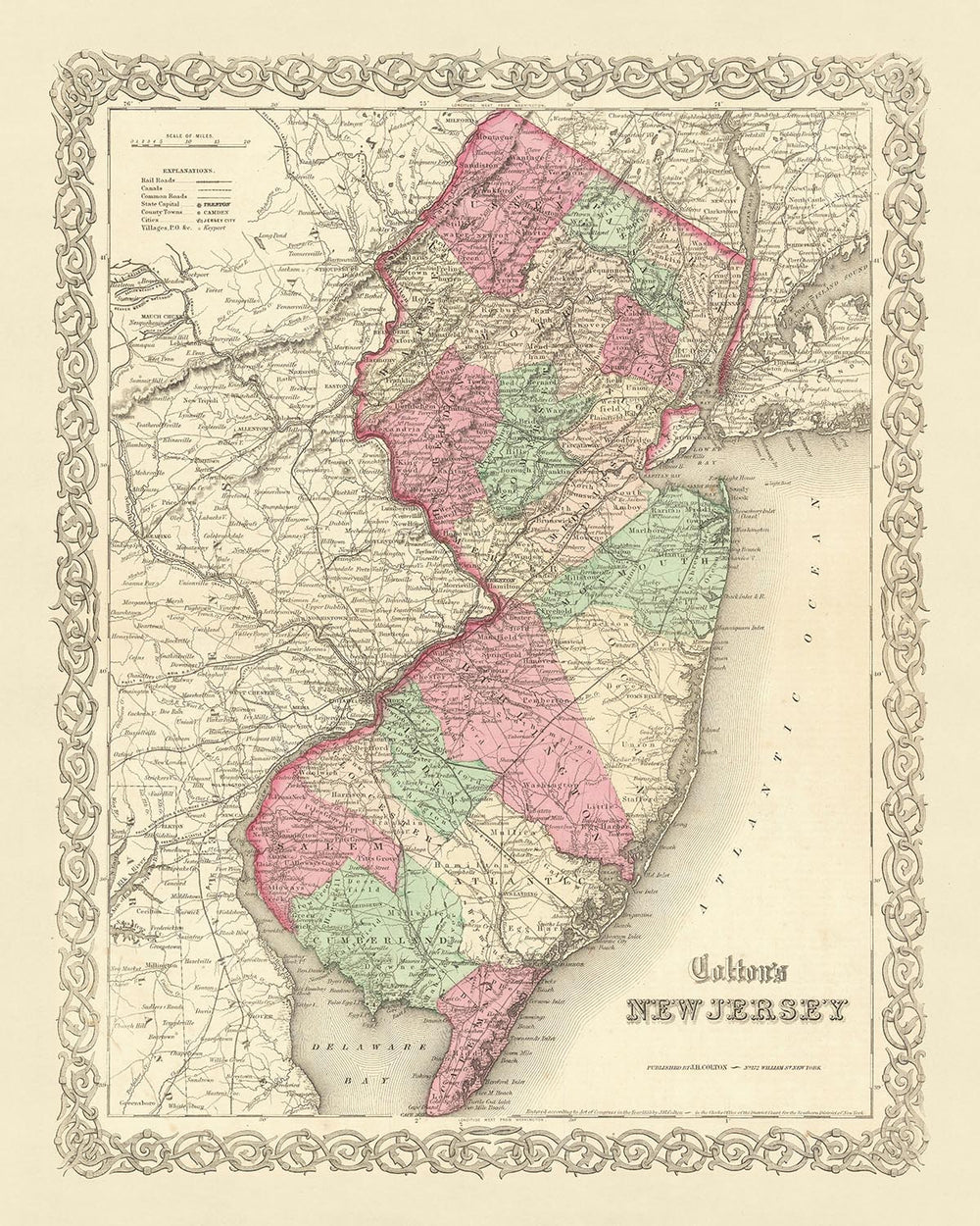
Please double check the images to make sure that a specific town or place is shown on this map. You can also get in touch and ask us to check the map for you.
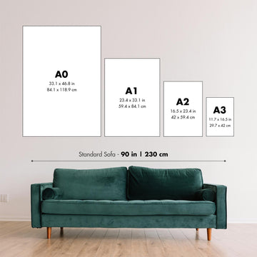
This map looks great at all sizes: 12x16in (30.5x41cm), 16x20in (40.5x51cm), 18x24in (45.5x61cm), 24x30in (61x76cm), 32x40in (81.5x102cm), 40x50in (102x127cm), 48x60in (122x153cm) and 56x70in (142x178cm), but it looks even better when printed large.
I can create beautiful, large prints of this map up to 70in (178cm). Please get in touch if you're looking for larger, customised or different framing options.
The model in the listing images is holding the 16x20in (40.5x51cm) version of this map.
The fifth listing image shows an example of my map personalisation service.
If you’re looking for something slightly different, check out my main collection of USA and North America maps.
Please contact me to check if a certain location, landmark or feature is shown on this map.
This would make a wonderful birthday, Christmas, Father's Day, work leaving, anniversary or housewarming gift for someone from the areas covered by this map.
This map is available as a giclée print on acid free archival matte paper, or you can buy it framed. The frame is a nice, simple black frame that suits most aesthetics. Please get in touch if you'd like a different frame colour or material. My frames are glazed with super-clear museum-grade acrylic (perspex/acrylite), which is significantly less reflective than glass, safer, and will always arrive in perfect condition.
This map is also available as a float framed canvas, sometimes known as a shadow gap framed canvas or canvas floater. The map is printed on artist's cotton canvas and then stretched over a handmade box frame. We then "float" the canvas inside a wooden frame, which is available in a range of colours (black, dark brown, oak, antique gold and white). This is a wonderful way to present a map without glazing in front. See some examples of float framed canvas maps and explore the differences between my different finishes.
For something truly unique, this map is also available in "Unique 3D", our trademarked process that dramatically transforms the map so that it has a wonderful sense of depth. We combine the original map with detailed topography and elevation data, so that mountains and the terrain really "pop". For more info and examples of 3D maps, check my Unique 3D page.
For most orders, delivery time is about 3 working days. Personalised and customised products take longer, as I have to do the personalisation and send it to you for approval, which usually takes 1 or 2 days.
Please note that very large framed orders usually take longer to make and deliver.
If you need your order to arrive by a certain date, please contact me before you order so that we can find the best way of making sure you get your order in time.
I print and frame maps and artwork in 23 countries around the world. This means your order will be made locally, which cuts down on delivery time and ensures that it won't be damaged during delivery. You'll never pay customs or import duty, and we'll put less CO2 into the air.
All of my maps and art prints are well packaged and sent in a rugged tube if unframed, or surrounded by foam if framed.
I try to send out all orders within 1 or 2 days of receiving your order, though some products (like face masks, mugs and tote bags) can take longer to make.
If you select Express Delivery at checkout your order we will prioritise your order and send it out by 1-day courier (Fedex, DHL, UPS, Parcelforce).
Next Day delivery is also available in some countries (US, UK, Singapore, UAE) but please try to order early in the day so that we can get it sent out on time.
My standard frame is a gallery style black ash hardwood frame. It is simple and quite modern looking. My standard frame is around 20mm (0.8in) wide.
I use super-clear acrylic (perspex/acrylite) for the frame glass. It's lighter and safer than glass - and it looks better, as the reflectivity is lower.
Six standard frame colours are available for free (black, dark brown, dark grey, oak, white and antique gold). Custom framing and mounting/matting is available if you're looking for something else.
Most maps, art and illustrations are also available as a framed canvas. We use matte (not shiny) cotton canvas, stretch it over a sustainably sourced box wood frame, and then 'float' the piece within a wood frame. The end result is quite beautiful, and there's no glazing to get in the way.
All frames are provided "ready to hang", with either a string or brackets on the back. Very large frames will have heavy duty hanging plates and/or a mounting baton. If you have any questions, please get in touch.
See some examples of my framed maps and framed canvas maps.
Alternatively, I can also supply old maps and artwork on canvas, foam board, cotton rag and other materials.
If you want to frame your map or artwork yourself, please read my size guide first.
My maps are extremely high quality reproductions of original maps.
I source original, rare maps from libraries, auction houses and private collections around the world, restore them at my London workshop, and then use specialist giclée inks and printers to create beautiful maps that look even better than the original.
My maps are printed on acid-free archival matte (not glossy) paper that feels very high quality and almost like card. In technical terms the paper weight/thickness is 10mil/200gsm. It's perfect for framing.
I print with Epson ultrachrome giclée UV fade resistant pigment inks - some of the best inks you can find.
I can also make maps on canvas, cotton rag and other exotic materials.
Learn more about The Unique Maps Co.
Map personalisation
If you're looking for the perfect anniversary or housewarming gift, I can personalise your map to make it truly unique. For example, I can add a short message, or highlight an important location, or add your family's coat of arms.
The options are almost infinite. Please see my map personalisation page for some wonderful examples of what's possible.
To order a personalised map, select "personalise your map" before adding it to your basket.
Get in touch if you're looking for more complex customisations and personalisations.
Map ageing
I have been asked hundreds of times over the years by customers if they could buy a map that looks even older.
Well, now you can, by selecting Aged before you add a map to your basket.
All the product photos you see on this page show the map in its Original form. This is what the map looks like today.
If you select Aged, I will age your map by hand, using a special and unique process developed through years of studying old maps, talking to researchers to understand the chemistry of aging paper, and of course... lots of practice!
If you're unsure, stick to the Original colour of the map. If you want something a bit darker and older looking, go for Aged.
If you are not happy with your order for any reason, contact me for a no-quibble refund. Please see our returns and refund policy for more information.
I am very confident you will like your restored map or art print. I have been doing this since 1984. I'm a 5-star Etsy seller. I have sold tens of thousands of maps and art prints and have over 5,000 real 5-star reviews.
I use a unique process to restore maps and artwork that is massively time consuming and labour intensive. Hunting down the original maps and illustrations can take months. I use state of the art and eye-wateringly expensive technology to scan and restore them. As a result, I guarantee my maps and art prints are a cut above the rest - that's why I can offer a no-quibble refund.
Almost all of my maps and art prints look amazing at large sizes (200cm, 6.5ft+) and I can frame and deliver them to you as well, via special oversized courier. Contact me to discuss your specific needs.
Or try searching for something!


