











Rare Old Map of the Moon, 1969: color photomosaic, shaded relief, far-side inset
Authentic artwork
The artwork we print is faithfully restored from the original source - usually a museum, auction house or private collection.
We never replace, redraw or invent the artist’s work using generative AI.
Restored in our London workshop from the original 1969 artwork and printed to museum-grade archival standards. Full description
The Collector’s Offer
Choose two eligible works and receive 20% off both. Choose three and the lowest-priced one is complimentary, a maximum saving of 33%.
Mix and match eligible standard maps and fine-art prints. No code is required; the offer is applied automatically at checkout.
Standard made-to-order configurations are included. Bespoke sizes, personalised designs and commissioned work are excluded.
Need delivery to different addresses? Contact us before ordering.The Collector’s Offer
Choose two eligible works and receive 20% off both. Choose three and the lowest-priced one is complimentary, a maximum saving of 33%.
Mix and match eligible standard maps and fine-art prints. No code is required; the offer is applied automatically at checkout.
Standard made-to-order configurations are included. Bespoke sizes, personalised designs and commissioned work are excluded.
Need delivery to different addresses? Contact us before ordering.
Authentic artwork
The artwork we print is faithfully restored from the original source - usually a museum, auction house or private collection.
We never replace, redraw or invent the artist’s work using generative AI.
Restored from the original 1969 artwork and printed to museum-grade archival standards. Full description
Choose your size
Choose your finish


(More info)
Gift message & custom finish

If you want to add a gift message, or a finish (jigsaw, aluminium board, etc.) that is not available here, please request it in the "order note" when you check out.
Every order is custom made, so if you need the size adjusted slightly, or printed on an unusual material, just let us know. We've done thousands of custom orders over the years, so there's (almost) nothing we can't manage.
You can also contact us before you order, if you prefer!
Chosen by collectors, designers and gift buyers
8,000+ five-star reviews


Created in 1969 at the height of the Apollo era, the Aeronautical Chart and Information Center’s Map of the Moon is a...
Continue readingCreated in 1969 at the height of the Apollo era, the Aeronautical Chart and Information Center’s Map of the Moon is a compelling synthesis of science, cartography, and exploration. Its chief subjects are lunar geography and topography, presented through a color photo mosaic enhanced by expert relief shading that lends the surface a striking three-dimensional presence. Place names, orientation marks at the poles, and a neatly organized coordinate grid frame an atlas-like portrait of the Moon at the very moment it became a navigable world. An inset of the far side completes the global view, making this map both a historical landmark of the space race and an enduring key to understanding our nearest celestial neighbor.
The map’s infographics translate complex geological information into intuitive visual language. High-resolution photographic tiles are blended into a seamless mosaic, while shaded relief models the subtleties of crater rims, rilles, and mountainous ramps, clarifying form at a glance. Informational text panels annotate major features and processes, and the labeled grid—using selenographic coordinates—lets viewers pinpoint locations with the precision required for mission planning. Cardinal directions and clearly marked poles resolve lunar orientation challenges that often confuse casual observers, effectively bridging the gap between raw imagery and field-ready chart. The result is a document that reads as both an authoritative reference and a visual narrative of the Moon’s formation and evolution.
Familiar landmarks are rendered with scientific clarity and aesthetic poise. Tycho’s radiant ray system fans across the southern highlands; Copernicus displays its broad, terraced walls and central peaks; Clavius spans the page with nested craters arching in grand procession. On the dark-floored Plato, subtle tone shifts hint at basaltic plains, while the intensely bright Aristarchus stands out as a beacon against surrounding terrain. The great lunar maria—Mare Imbrium, Mare Serenitatis, Mare Tranquillitatis, and Mare Nubium—are distinguished by tonal contrasts and edge-shadowing that outline ancient basins and wrinkle ridges. Mountain arcs and ridgelines rise convincingly from the shading, and discreet scientific symbols flag areas of interest, including markers for prospective landing sites that forecast the next chapters of lunar exploration.
The far-side inset is a concise masterclass in comparative selenography. By isolating the hemisphere long hidden from Earth, it invites a direct visual comparison: densely cratered highlands dominate, maria are scarce, and basin structures differ in character from the familiar near-side seas. The same symbology—place names where established, a fine coordinate mesh, and relief shading—ensures continuity with the main map. Clearly indicated polar references aid orientation in this less intuitive vista. Together, these panels provide a complete, globally consistent dataset that supports everything from classroom discovery to professional study of crustal asymmetry, impact history, and the geologic forces that sculpted the lunar surface.
The ACIC’s cartographic rigor underpins every element. Known for supplying precision charts to aviators and astronauts alike, the center pioneered controlled lunar photomosaics and photogrammetric methods that helped narrow Apollo-era landing choices, including the storied Mare Tranquillitatis. Their style—clean hierarchies of type, measured use of color, and disciplined symbology—derives from aeronautical charting, where legibility is mission-critical. Here, that discipline becomes an elegant design language: labels clarify without clutter, grids guide without distraction, and annotations enrich without overwhelming. As a historical artifact, the map captures the optimism and exactitude of 1969; as a scientific tool, it remains a lucid gateway to the Moon’s grand relief and enduring mysteries.
Places on this map
- Craters:
- Tycho
- Copernicus
- Clavius
- Plato
- Aristarchus
- Maria (Lunar Plains):
- Mare Imbrium
- Mare Serenitatis
- Mare Tranquillitatis
- Mare Nubium
- Highlands: Areas like the lunar highlands visible on the map.
- Ridges and Mountains: Various mountain ranges and ridges in lunar geography.
- Scientific Features: Additional markers indicating potential landing sites for future missions.
Notable Features & Landmarks
- Topographical Shading: Displays the relief of the lunar surface.
- Place Names: Various craters and plains are labeled.
- Inset for Far Side: A visual section dedicated to the Moon's far side.
- North and South Poles: Clearly marked orientation indicating cardinal directions.
- Photo Mosaic Technique: Use of high-resolution images for detailed representation.
- Informational Text: Provides insights into the features of the Moon.
- Coordinates Grid: Labeled rows and columns for navigation reference.
Historical and design context
- Publisher: Created by the Aeronautical Chart and Information Center, United States Air Force in 1969.
- Mapmaker Context: The Aeronautical Chart and Information Center (ACIC) provided crucial mapping services for military and scientific purposes and was pivotal during the lunar exploration era.
- Topics and Themes: The scientific exploration of the Moon, especially during the Apollo program era.
- Topics and Themes: Presentation of data through infographics that communicate complex geological information effectively.
- Countries/Regions Shown: Not applicable, as this map is focused solely on the Moon.
- Historical Significance: Represents the peak of scientific interest in lunar geography during the space race and aids in navigation and research for future lunar missions.
Looking for a particular place? Review the detailed images to confirm that the town, landmark or feature you have in mind appears on the map. If you are unsure, ask our workshop to check before you order.
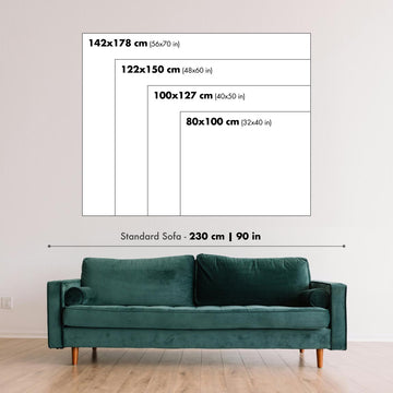
Detailed maps are especially rewarding at larger sizes, where names, boundaries and decorative features have more room to be appreciated. Use the close-up preview and size guide to choose the right scale for your wall.
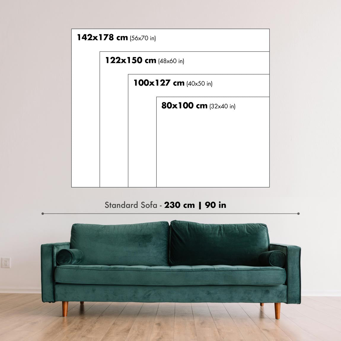
This map looks amazing at sizes all the way up to 90in (230cm). If you are looking for a larger map, please get in touch.
The model in the listing images is holding the 18x24in (45x60cm) version of this map.
Where personalisation is available, you can add a short title or dedication, mark one meaningful place, or request one considered visual detail. See personalised map examples.
Every piece is printed to museum-grade archival standards using fade-resistant pigment inks on acid-free matte paper. Choose an unframed map print, framed map or canvas using the finish options above. Framed maps use crystal-clear optical acrylic and arrive ready to hang.
With its rich detail and strong sense of place, this map makes a considered gift for a new home, anniversary, retirement or anyone with a personal connection to the area shown. Still deciding? Explore our collection of rare old and vintage maps to discover another place, period or style.
This artwork is also available as a float framed canvas, sometimes known as a shadow gap framed canvas or canvas floater. The work is printed on artist's cotton canvas and then stretched over a handmade box frame. We then "float" the canvas inside a wooden frame, which is available in a range of colours (black, dark brown, oak, antique gold and white). This is a wonderful way to present an art print without glazing in front. See some examples of float framed canvas art and explore the differences between my different finishes.
Created in 1969 at the height of the Apollo era, the Aeronautical Chart and Information Center’s Map of the Moon is a compelling synthesis of science, cartography, and exploration. Its chief subjects are lunar geography and topography, presented through a color photo mosaic enhanced by expert relief shading that lends the surface a striking three-dimensional presence. Place names, orientation marks at the poles, and a neatly organized coordinate grid frame an atlas-like portrait of the Moon at the very moment it became a navigable world. An inset of the far side completes the global view, making this map both a historical landmark of the space race and an enduring key to understanding our nearest celestial neighbor.
The map’s infographics translate complex geological information into intuitive visual language. High-resolution photographic tiles are blended into a seamless mosaic, while shaded relief models the subtleties of crater rims, rilles, and mountainous ramps, clarifying form at a glance. Informational text panels annotate major features and processes, and the labeled grid—using selenographic coordinates—lets viewers pinpoint locations with the precision required for mission planning. Cardinal directions and clearly marked poles resolve lunar orientation challenges that often confuse casual observers, effectively bridging the gap between raw imagery and field-ready chart. The result is a document that reads as both an authoritative reference and a visual narrative of the Moon’s formation and evolution.
Familiar landmarks are rendered with scientific clarity and aesthetic poise. Tycho’s radiant ray system fans across the southern highlands; Copernicus displays its broad, terraced walls and central peaks; Clavius spans the page with nested craters arching in grand procession. On the dark-floored Plato, subtle tone shifts hint at basaltic plains, while the intensely bright Aristarchus stands out as a beacon against surrounding terrain. The great lunar maria—Mare Imbrium, Mare Serenitatis, Mare Tranquillitatis, and Mare Nubium—are distinguished by tonal contrasts and edge-shadowing that outline ancient basins and wrinkle ridges. Mountain arcs and ridgelines rise convincingly from the shading, and discreet scientific symbols flag areas of interest, including markers for prospective landing sites that forecast the next chapters of lunar exploration.
The far-side inset is a concise masterclass in comparative selenography. By isolating the hemisphere long hidden from Earth, it invites a direct visual comparison: densely cratered highlands dominate, maria are scarce, and basin structures differ in character from the familiar near-side seas. The same symbology—place names where established, a fine coordinate mesh, and relief shading—ensures continuity with the main map. Clearly indicated polar references aid orientation in this less intuitive vista. Together, these panels provide a complete, globally consistent dataset that supports everything from classroom discovery to professional study of crustal asymmetry, impact history, and the geologic forces that sculpted the lunar surface.
The ACIC’s cartographic rigor underpins every element. Known for supplying precision charts to aviators and astronauts alike, the center pioneered controlled lunar photomosaics and photogrammetric methods that helped narrow Apollo-era landing choices, including the storied Mare Tranquillitatis. Their style—clean hierarchies of type, measured use of color, and disciplined symbology—derives from aeronautical charting, where legibility is mission-critical. Here, that discipline becomes an elegant design language: labels clarify without clutter, grids guide without distraction, and annotations enrich without overwhelming. As a historical artifact, the map captures the optimism and exactitude of 1969; as a scientific tool, it remains a lucid gateway to the Moon’s grand relief and enduring mysteries.
Places on this map
- Craters:
- Tycho
- Copernicus
- Clavius
- Plato
- Aristarchus
- Maria (Lunar Plains):
- Mare Imbrium
- Mare Serenitatis
- Mare Tranquillitatis
- Mare Nubium
- Highlands: Areas like the lunar highlands visible on the map.
- Ridges and Mountains: Various mountain ranges and ridges in lunar geography.
- Scientific Features: Additional markers indicating potential landing sites for future missions.
Notable Features & Landmarks
- Topographical Shading: Displays the relief of the lunar surface.
- Place Names: Various craters and plains are labeled.
- Inset for Far Side: A visual section dedicated to the Moon's far side.
- North and South Poles: Clearly marked orientation indicating cardinal directions.
- Photo Mosaic Technique: Use of high-resolution images for detailed representation.
- Informational Text: Provides insights into the features of the Moon.
- Coordinates Grid: Labeled rows and columns for navigation reference.
Historical and design context
- Publisher: Created by the Aeronautical Chart and Information Center, United States Air Force in 1969.
- Mapmaker Context: The Aeronautical Chart and Information Center (ACIC) provided crucial mapping services for military and scientific purposes and was pivotal during the lunar exploration era.
- Topics and Themes: The scientific exploration of the Moon, especially during the Apollo program era.
- Topics and Themes: Presentation of data through infographics that communicate complex geological information effectively.
- Countries/Regions Shown: Not applicable, as this map is focused solely on the Moon.
- Historical Significance: Represents the peak of scientific interest in lunar geography during the space race and aids in navigation and research for future lunar missions.
Looking for a particular place? Review the detailed images to confirm that the town, landmark or feature you have in mind appears on the map. If you are unsure, ask our workshop to check before you order.
Detailed maps are especially rewarding at larger sizes, where names, boundaries and decorative features have more room to be appreciated. Use the close-up preview and size guide to choose the right scale for your wall.
This map looks amazing at sizes all the way up to 90in (230cm). If you are looking for a larger map, please get in touch.
The model in the listing images is holding the 18x24in (45x60cm) version of this map.
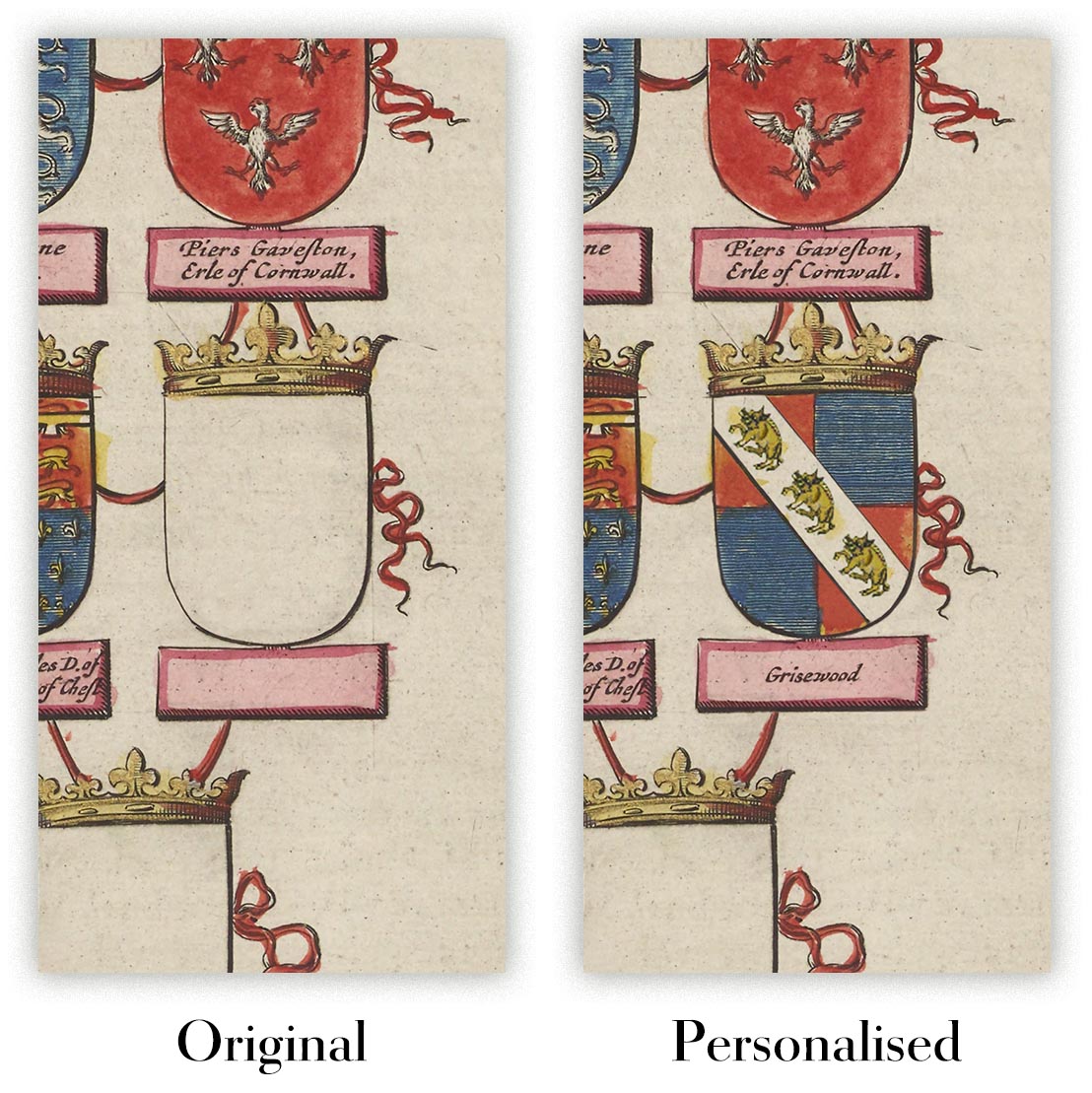
Where personalisation is available, you can add a short title or dedication, mark one meaningful place, or request one considered visual detail. See personalised map examples.
Every piece is printed to museum-grade archival standards using fade-resistant pigment inks on acid-free matte paper. Choose an unframed map print, framed map or canvas using the finish options above. Framed maps use crystal-clear optical acrylic and arrive ready to hang.
With its rich detail and strong sense of place, this map makes a considered gift for a new home, anniversary, retirement or anyone with a personal connection to the area shown. Still deciding? Explore our collection of rare old and vintage maps to discover another place, period or style.
This artwork is also available as a float framed canvas, sometimes known as a shadow gap framed canvas or canvas floater. The work is printed on artist's cotton canvas and then stretched over a handmade box frame. We then "float" the canvas inside a wooden frame, which is available in a range of colours (black, dark brown, oak, antique gold and white). This is a wonderful way to present an art print without glazing in front. See some examples of float framed canvas art and explore the differences between my different finishes.
Many of our maps and art prints are chosen as thoughtful gifts for homes, offices, studies and meaningful places.
Choose a framed option for the easiest ready-to-hang gift, or choose an unframed print if the recipient may prefer to select their own frame.
We make orders locally in 24 countries around the world, so gifts can often be produced close to the recipient. This helps them arrive faster, travel more safely, and avoid customs or import duty surprises.
- We can deliver directly to the recipient
- Framed pieces arrive ready to hang
- Unframed prints are carefully packed in a strong protective tube
- Almost every order is made locally, for faster, safer gifting
- 90-day returns give the recipient time to decide
If you are not sure what to choose, please contact us. We can help you pick the right map, size, finish or delivery option.
Most orders are made locally and delivered in around 2–3 working days, depending on the product, size and destination.
We print and frame maps and artwork in 24 countries around the world, so your order is usually made close to you or your recipient. That means faster delivery, less time in transit, and no customs or import duty surprises.
Personalised and customised pieces usually take an extra 1–2 working days, because we prepare your design and send it to you for approval before printing.
Very large framed orders can take a little longer, as they need extra care in production and delivery.
Every order is carefully packaged: unframed prints are sent in a strong protective tube, while framed pieces are securely packed with protective materials around the frame.
If you need your order by a particular date, please contact us before ordering. We’ll check the best production route and delivery option for your location.
Express delivery is available at checkout for most countries. Next-day delivery is available in the UK, US, Singapore and the UAE.
Your order is covered by our 90-day returns policy and 10-year guarantee.
Our standard frame is a gallery-style black ash hardwood frame, with a simple, modern look. It is approximately 20mm (0.8in) wide. You can also view some lovely customer photos of framed maps and art.
We use super-clear acrylic glazing, also known as Perspex or Acrylite, instead of traditional glass. It is lighter, safer, and has lower reflectivity, giving the artwork a clearer, cleaner appearance.
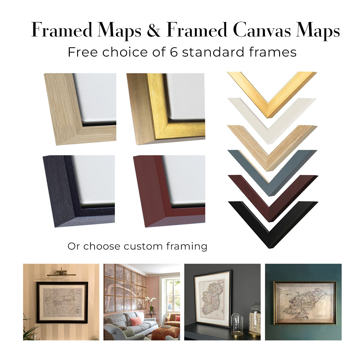
Six standard frame colours are available at no extra cost: black, dark brown, dark grey, oak, white, and antique gold. Custom framing and mounting/matting is also available for customers looking for something more specific.
Most maps, art prints, and illustrations are also available as a framed canvas. We use matte cotton canvas, stretch it over a sustainably sourced wooden box frame, and then float the piece within a wooden outer frame. The finished result is beautifully presented, with no glazing between you and the artwork.
All frames are supplied ready to hang, with either string or brackets fitted to the back. Very large frames will include heavy-duty hanging plates and/or a mounting baton. If you have any questions, please get in touch.
We can also supply old maps and artwork on canvas, foam board, cotton rag, and other materials.
If you would prefer to frame your map or artwork yourself, please read our size guide before ordering.
We work with interior designers, hospitality businesses, property professionals, offices and corporate buyers on individual pieces and larger coordinated projects.
This artwork can be adapted for a particular wall, room or project, and our workshop can help coordinate the dimensions, material and framing before production.
- Exact, oversized and made-to-measure dimensions
- Custom framing, mounting and alternative materials
- Coordinated pieces for several rooms or locations
- Art personalisation, to adjust the colour and style of the piece
- Art and framing guidance from our workshop
- Local production for projects around the world
Every restored art print begins with the original artist’s work—never an AI-generated replacement.
Our London studio works from carefully selected source material from museums, libraries, archives and private collections. We restore age-related damage, faded colour and imperfect reproduction while preserving the artist’s composition, brushwork, line, texture and period character.
We do not use generative AI to redraw, reinterpret or invent the artwork. Digital restoration is used only to recover and reproduce the original work as faithfully as possible.
Once restored, the master artwork is prepared for your chosen size and finish. Your piece is then printed and, where selected, framed close to its delivery destination.
Our giclée art prints use acid-free 200gsm archival matte paper and fade-resistant pigment inks for a rich, museum-quality finish. Framed art prints use crystal-clear optical acrylic and arrive ready to hang.
Framed canvas and specialist cotton-rag editions are also available. Learn more about our materials and finishes.
We’ve been restoring and producing maps and art prints since 1984, and we stand behind every piece.
Every order is covered by our 10-year guarantee and damage-free delivery guarantee. If your piece arrives damaged, we’ll replace or remake it free of charge. If anything else isn’t right, contact our workshop team and we’ll put it right promptly.
See our returns and refund policy for full details.


